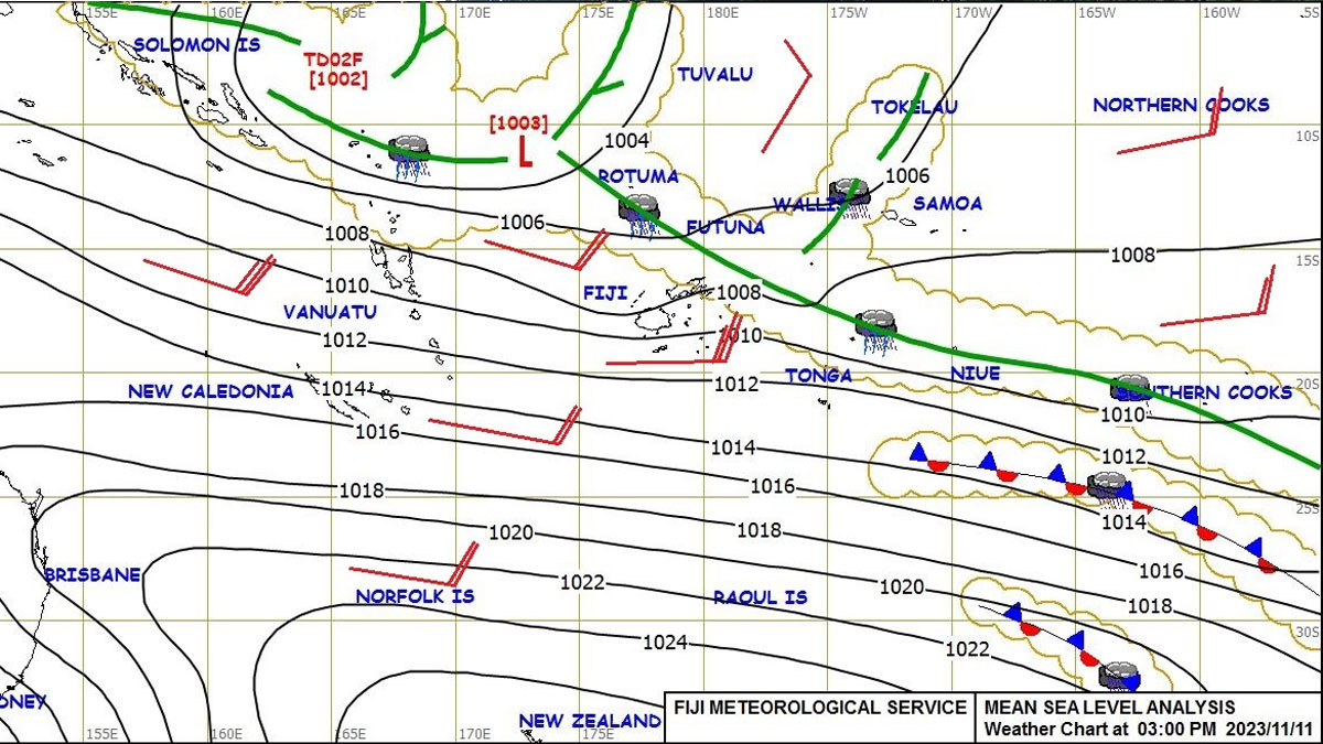
A tropical disturbance, TD02F, has been analysed 650 kilometres east-northeast of Honiara, Solomon Islands, and is expected to drift towards the Fiji Group by early next week.
The Nadi Weather Office says while the chances of TD02F to intensify into a tropical cyclone is low for today and tomorrow, it increases to moderate to high by next Tuesday.
The Weather Office will continue to monitor the situation as the system develops and will issue advisories as and when necessary.
Stay with us for the latest updates.
Meanwhile, a Heavy Rain Alert remains in force for the Northern Division, Yasawa, Mamanuca, Lau and Lomaiviti Groups. Rain and thunderstorms with isolated heavy falls expected over these areas from later tonight.
This is expected to spread over the rest of the country from later tomorrow.
This rain is due to a trough of low pressure with associated cloud and rain that lies slow moving to the north of Fiji.
It is expected to drift south and affect the northern and eastern parts of the group from later today.
Localised flooding of low-lying and flood-prone areas; localised flooding of minor roads, Irish crossings and bridges with some disruption to traffic flow; and poor visibility out at sea and as well as on land with increased risk of motor vehicle accidents due to slippery roads is expected for areas under the Heavy Rain Alert.
A strong wind warning is in place for the land areas of Yasawa, Lau and Lomaiviti Groups, coastal areas from Sigatoka to Suva to Rakiraki, Kadavu and nearby smaller islands, Taveuni and nearby smaller islands, southern Bua, Cakaudrove and eastern Macuata.
Strong southeast winds with speeds up to 45 kilometres per hour and gusts up to 55 kilometres per hour is expected over these land areas.
These winds are driven by a high-pressure system to the far south of Fiji that is generating and directing a fresh to strong southeasterly wind flow over Fiji.
A Strong Wind Warning remains in force for all Fiji Waters.
Stay tuned for the latest news on our radio stations

