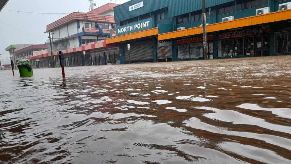
People living in Nausori are facing damaging winds and heavy rain as TC Ana moves towards the Central Division.
Tropical Cyclone Ana was upgraded to a Category 3 system on February 1st.
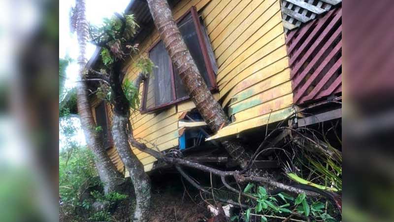
A family of six from Soasoa Labasa are counting their lucky stars after they escaped unharmed when a landslide moved their house by almost 10 metres during the heavy rain brought by TC Ana.
Kamlesh Kumar says his parents, brother, sister-in-law and 2 nieces managed to move out of the house moments before the incident.
Kumar says at around midday Sunday, his family could feel something was about to happen as they could feel their house moving.
He adds they didn’t take any risk and moved out immediately.
The family is currently living with other relatives as they wait for things to normalise before they start repair works.
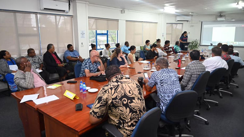
The National Disaster Management Office is yet to confirm whether people should return to work today as flood waters are still rising in some areas and TC Bina heads towards Fiji however we have received reports that only a handful of workers are turning to work in some places.
All students, teachers and staff are to stay at home as schools will remain closed until further notice.
Minister for Education Rosy Akbar says they will advise the public through a media announcement when schools will reopen as many schools are currently being used as Evacuation Centres.
Bus services will be provided today but there will be limited trips.
Fiji Bus Operators Association President Nisar Ali Shah says companies have been advised to decide for themselves if it is safe to operate or not.
He says a few companies have indicated that they will operate today, with the exception of areas that are flooded or roads that have been damaged.
The National Disaster Management Office is urging businesses to ensure the safety of staff and customers during their operations.
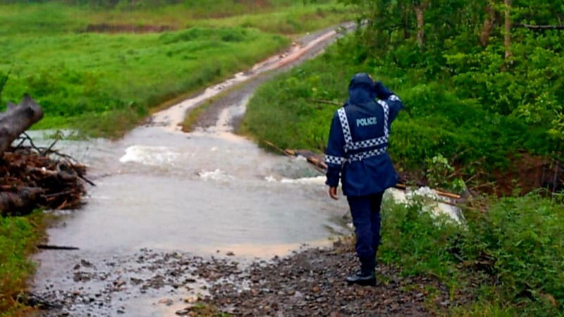
Tropical Cyclone Ana has claimed the life of a 49-year-old man while five other people are still missing.
The man drowned in a river near Waikubukubu Village in Nadarivatu on Friday.
Among those reported missing is a 3-year-old boy in Lautoka.
Police say the boy went missing while accompanying his grandfather on Friday to check their boat which was stuck in the mangrove plants along the Velovelo seaside area in Lautoka.
Two fishermen who were reported missing on Wednesday are still missing.
They had left Cikobia Village for Vunikodi Village in Macuata in a fibreglass boat.
Two women who went fishing in Vatuwaqa have also been missing since Thursday.
Please call Police if you have any information.
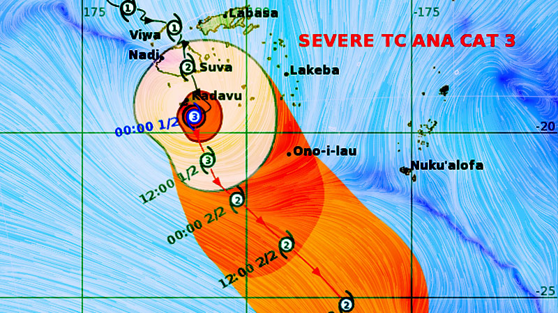
Tropical Cyclone Ana upgraded to a Category 3 system this morning.
The Nadi Weather Office says the centre of TC Ana has moved past Kadavu but people living in Kadavu and nearby smaller islands, Viti Levu and Vanua Levu can still expect some strong winds from TC Ana as it is a very big system.
TC Ana is moving south at about 13 kilometres per hour.
It is located 150 kilometres West South-West of Matuku.
The Nadi Weather Office says TC Ana is expected to weaken as it moves further south and leaves the Fiji group later today.
TC Ana has left a trail of destruction in Viti Levu, Vanua Levu and Kadavu.
There was heavy flooding in many areas in Viti Levu and Vanua Levu.
Entire settlements and villages were covered with flood waters leaving many stranded and getting the help of police officers to move to evacuation centres or high ground.
Flood waters are just starting to recede this morning in many of these areas.
Many homes with weak structures have also been damaged while trees and power poles were brought down as people experienced strong to damaging and then destructive winds.
In Kadavu, we have already received reports of damage to homes in some villages.
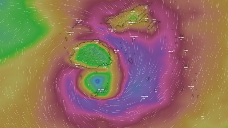
The centre of TC Ana is currently between the coast of Suva and Navua as it continues to move towards Kadavu.
Acting Director for the Nadi Weather Office, Terry Atalifo says people can still expect heavy rain, damaging to destructive winds and flooding for today and tomorrow.
The centre of TC Ana was located 70km North-Northwest of Suva this morning.
It is moving South-Southeast at about 13km per hour.
We have been receiving reports of heavy flooding in many areas in Viti Levu and Vanua Levu. Many people have also been experiencing strong to damaging and then to destructive winds which has even brought down trees, power poles and weak structures.
Please stay safe and stay with us for updates.
The Category 2 destructive winds being experienced will continue for the most part of later today as the system has moved slowly from last night to today bringing torrential rain, damaging to destructive winds.
If you are living in Viti Levu, Northern parts of Vanua Levu which include areas from Labasa, Seaqaqa and Savusavu, Kadavu, Beqa, Lomaiviti Group and Moala, there is a storm warning in place for you which means you will face destructive winds that has the potential to cause significant damage to trees, damage weak structures and houses and heavy damage to crops, disrupt electrical power distribution and communication services.
The Weather Office says the wind is expected to intensify as the system continues to move over Viti Levu today.
The whole of Fiji will continue to experience damaging winds.
You will experience damaging winds a few hours before and after the centre of Cyclone Ana passes overhead or nearby.
A tropical cyclone warning remains in place for Fiji.
TC Ana was located about 70 kilometres North North West of Suva.
The Nadi Weather Office says people can expect winds of up to 95 kilometres per hour with momentary gusts of up to 130 kilometres per hour.
There is also a heavy rain warning for the whole of Fiji.
There is an increased risk of landslides, flash flooding of low lying areas and flooding of streams and rivers as the ground is already saturated.
A flash flood warning remains in force for all low lying areas and small streams near major rivers of Viti Levu and Vanua Levu.
Stay safe and do not go outdoors.
You can also contact Police on 917, the National Fire Authority on 910, Energy Fiji Limited on 913, Water Authority on 5777 and FRA on 5720.
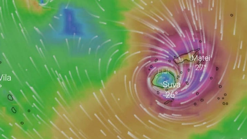
The Centre of Tropical Cyclone Ana is expected to exit Viti Levu from midday to late in the afternoon today and head towards Kadavu however as forecast please expect destructive winds for most part of today.
The centre made landfall in Ra at around 6 this morning.
We have been receiving reports of heavy flooding in many areas in Viti Levu and Vanua Levu. Many people have also been experiencing strong to damaging and then to destructive winds which has even brought down trees, power poles and weak structures.
Please stay safe and stay with us for updates.
The Category 2 destructive winds being experienced will continue for the most part of this morning into later today as the system has moved slowly from last night to today bringing torrential rain, damaging to destructive winds.
If you are living in Viti Levu, Northern parts of Vanua Levu which includes areas from Labasa, Seaqaqa and Savusavu, Kadavu, Beqa, Lomaiviti Group and Moala, there is a storm warning in place for you which means you will face destructive winds that has the potential to cause significant damage to trees, damage weak structures and houses and heavy damage to crops, disrupt electrical power distribution and communication services
The Weather Office says the wind is expected to intensify as the system continues to move over Viti Levu today.
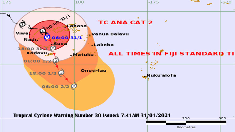
The whole of Fiji will continue to experience damaging winds.
You will experience damaging winds a few hours before and after the centre of Cyclone Ana passes overhead or nearby.
A tropical cyclone warning remains in place for Fiji.
TC Ana was located about 70 kilometres North East of Nadi.
The Nadi Weather Office says people can expect winds of up to 95 kilometres per hour with momentary gusts of up to 130 kilometres per hour.
There is also a heavy rain warning for the whole of Fiji.
There is an increased risk of landslides, flash flooding of low lying areas and flooding of streams and rivers as the ground is already saturated.
A flash flood warning remains in force for all low lying areas and small streams near major rivers of Viti Levu and Vanua Levu.
Stay safe and do not go outdoors.
You can also contact Police on 917, the National Fire Authority on 910, Energy Fiji Limited on 913, Water Authority on 5777 and FRA on 5720.
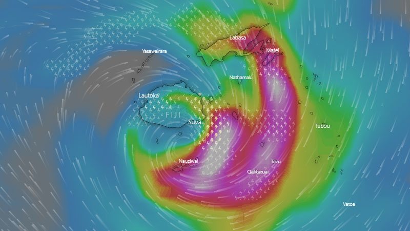
Tropical Cyclone Ana continues to move closer to Kadavu as it has picked up speed but if you live in Viti Levu and Vanua Levu you should still expect strong winds tonight.
Parts of the system are still covering Viti Levu, Vanua Levu and nearby islands. You can still expect strong to damaging winds in Viti Levu, Vanua Levu, Vatulele, Beqa, Lomaiviti group and Moala.
People living in Kadavu will continue to experience damaging to destructive winds and heavy rain tonight into tomorrow.
They can expect destructive winds with an average speed of 100 kilometres per hour to momentary gusts of 140 kilometres per hour.
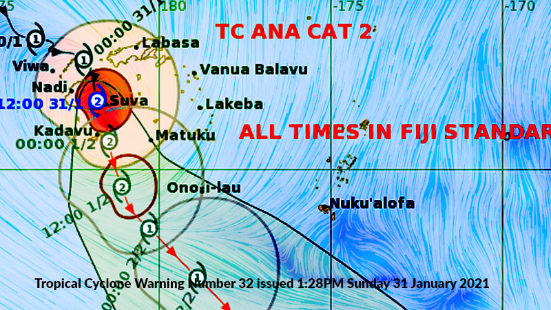
TC Ana is still a Category 2 system.
It is located 45 kilometres East North East of Kadavu.
TC Ana is moving South South-East at about 19 kilometres per hour.
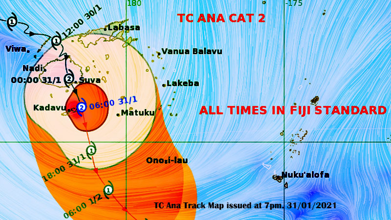
TC Ana Threat Map issued at 7pm. 31/01/2021. [image: Fiji Met]
The Nadi Weather Office says you should continue to expect heavy rain at times and this will continue to cause more flash flooding along roads, villages, towns and communities near streams, rivers and low lying areas.
If you live near the coastal areas continue to expect sea flooding and possible coastal inundation especially during high tide.
The Nadi Weather Office says there is still a flood warning and flash flood warning is in force for all low lying areas close to small streams and major rivers in Fiji.
Please stay safe and stay with us for updates.
A heavy rain warning is still in force for the whole of Fiji.
There is also a Tropical Cyclone warning that is still in force for the whole of Fiji.
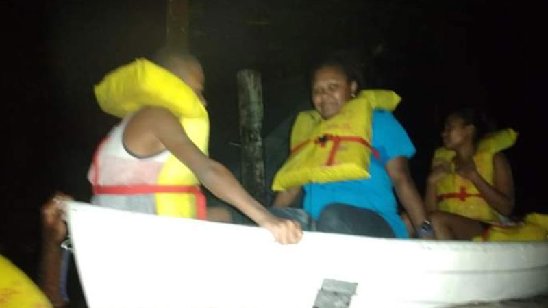
A mother and her two children of Salababa Road in Waila in Nausori are grateful to officers from the Fiji Police Force who rescued them from rapidly rising flood waters last night.
Seini Ledua says they live in a double storey house and feared the worst for her family when flood waters reached the top of the first floor.
Ledua says it was a scary situation especially for her children aged 10 and 14 who were too frightened to move out.
Insert: Frightened 31st January
Ledua and her children were rescued after the NDMO was notified of a social media post by her brother.
Divers from the Fiji Police Force were then deployed to rescue them.
She says she cannot explain how she felt when she saw help arrive and has thanked the officers for the assistance.
Ledua and her children are currently in an evacuation centre.
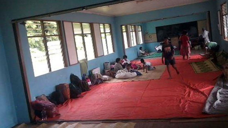
More than 100 people of Nawadamu community in Labasa are sheltering at their community hall.
Trisha Banuve says there is still heavy rain and strong winds but their main concern is food and water.
She says all their homes are flooded.
Banuve says the children and women are sheltering inside the hall while the men are outside.
They are hopeful that assistance will arrive for them.
We have informed Police and the NDMO about their situation.

You should continue to expect damaging to destructive winds if you live in Viti Levu, Northern Vanua Levu and Kadavu although the centre of Cyclone Ana has passed Viti Levu and is now moving closer to Kadavu.
If you live in Viti Levu and Vanua Levu, the winds you can expect to continue to experience tonight and tomorrow is the direct effects from the second part of Cyclone Ana.
The Nadi Weather Office says the warnings remain the same and people can still expect heavy rain, damaging to destructive winds and flooding for tonight and tomorrow.
The centre of TC Ana is located about 30 kilometres North North-East of Kadavu.
Cyclone Ana is moving slowly at 11 kilometres per hour.
Kadavu has been experiencing strong winds and heavy rain.
There has also been heavy flooding in many areas in Viti Levu and Vanua Levu.
Many people have also been experiencing strong to damaging and then to destructive winds which has even brought down trees, power poles and weak structures.
The Nadi Weather Office says you should continue to expect heavy rain at times and this will continue to cause more flash flooding along roads, villages, towns and communities near streams, rivers and low lying areas.
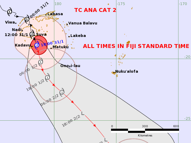
TC Ana track map issued at 7pm. 31/01/2021 . [Image: Fiji Met ]
If you live near the coastal areas continue to expect sea flooding and possible coastal inundation especially during high tide.
The Nadi Weather Office says there is still a flood warning and flash flood warning is force for all low lying areas close to small streams and major rivers in Fiji.
Please stay safe and stay with us for updates.
The Category 2 destructive winds being experienced will continue for the most part of tonight as the system has moved slowly from last night to today bringing torrential rain, damaging to destructive winds.
If you are living in Viti Levu, Northern parts of Vanua Levu which include areas from Labasa, Seaqaqa and Savusavu, Kadavu, Beqa, Lomaiviti Group and Moala, there is a storm warning in place for you which means you will face destructive winds that has the potential to cause significant damage to trees, damage weak structures and houses and heavy damage to crops, disrupt electrical power distribution and communication services.
The whole of Fiji will continue to experience damaging winds.
You will experience damaging winds a few hours before and after the centre of Cyclone Ana passes overhead or nearby.
A tropical cyclone warning remains in place for Fiji.
The Nadi Weather Office says people can expect winds of up to 95 kilometres per hour with momentary gusts of up to 130 kilometres per hour.
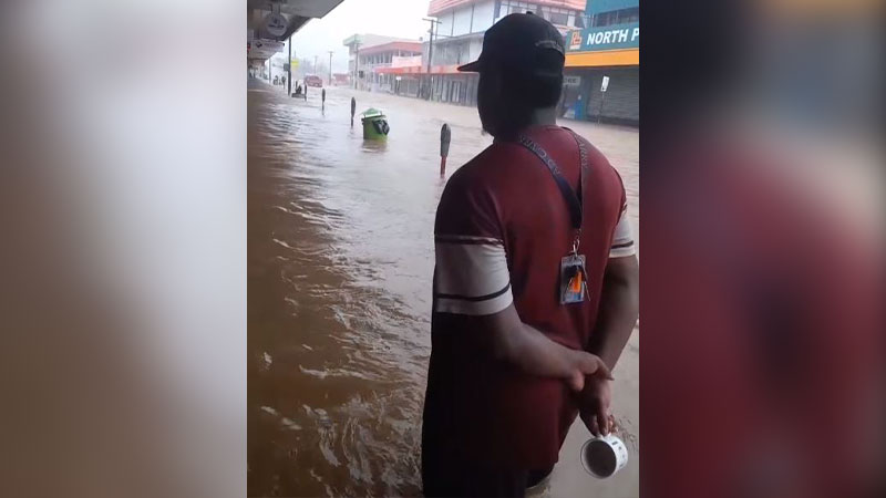
There continue to be reports of people wandering around despite warnings that Fiji is still being affected by TC Ana.
The NDMO says there is still widespread flooding and they continue to receive reports of adults and children wandering around.
Director Vasiti Soko says people should be mindful of the risks police officers are being placed in when they are deployed to rescue people.
Soko says people should stay home and should not keep police officers from other duties such as assisting people to move to evacuation centres.
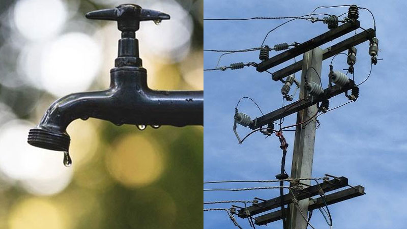
If you are without water and electricity at the moment, expect it to be out for some time as the National Disaster Management Office says Energy Fiji Limited and the Water Authority of Fiji crews will be mobilised after TC Ana has passed.
They are asking people to bear with them for now.
Please stay away from fallen power lines and call EFL on 913 for emergencies.
If you are affected by water disruptions, please boil your drinking water to reduce the risk of waterborne diseases.
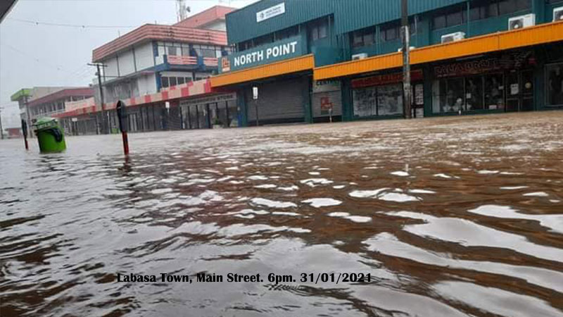
Flood waters have started to rise again in Vuniqari in Tabia, Labasa.
Resident Nilesh Deo says there are around 15 families in the area and all their crops have been destroyed due to flooding.
Deo says flood waters started to rise again at around 3pm today.
He says they are still experiencing heavy rain and strong winds.
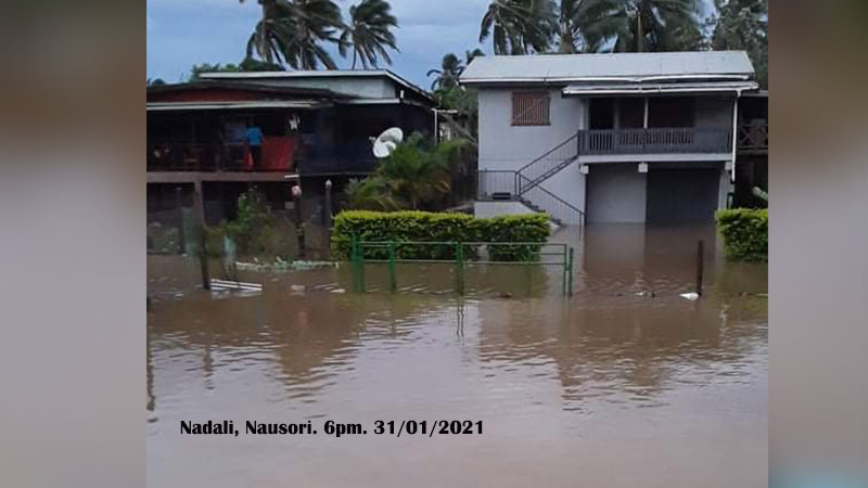
Flood waters have started to rise in Nadali, Nausori.
A resident Faria Begum has told us that they experienced heavy rain today and it started to flood this afternoon.
Begum adds a few of their neighbours have moved to evacuation centres because flood waters have started to enter their homes.
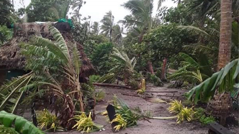
A resident of Naicucuqu Settlement in Galoa Island in Kadavu, Frank Whippy says the heavy rain and strong winds they were experiencing have eased as they believe the eye of TC Ana is over them at the moment.
Whippy says they have been experiencing this weather since 4 o’clock this morning, and it started to ease at 5 o’clock this afternoon.
He says there have also been high waves.
You should continue to expect damaging to destructive winds if you live in Viti Levu, Northern Vanua Levu and Kadavu although the centre of Cyclone Ana has passed Viti Levu and is currently between the waters of Kadavu and Viti Levu.
If you live in Viti Levu and Vanua Levu, the winds you can expect to continue to experience tonight and tomorrow is the direct effects from the second part of Cyclone Ana.
The Nadi Weather Office says people in Kadavu can still expect heavy rain, damaging to destructive winds and flooding tonight and tomorrow.
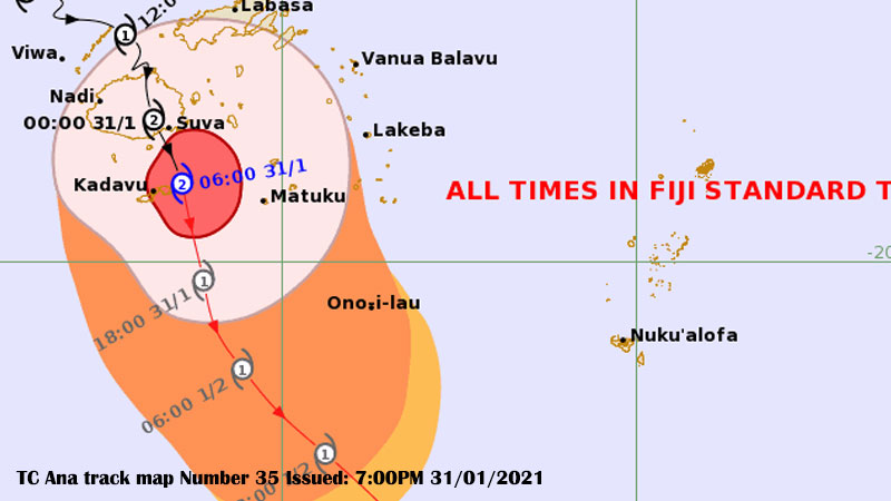
You should continue to expect damaging to destructive winds if you live in Viti Levu, Northern Vanua Levu and Kadavu although the centre of Cyclone Ana has passed Viti Levu and is currently between the waters of Kadavu and Viti Levu.
If you live in Viti Levu and Vanua Levu, the winds you can expect to continue to experience tonight and tomorrow is the direct effects from the second part of Cyclone Ana.
The Acting Director of the Nadi Weather Office, Terry Atalifo says the warnings remain the same and people can still expect heavy rain, damaging to destructive winds and flooding for tonight and tomorrow.
The centre of TC Ana is located about 30 kilometres North North-East of Kadavu.
Cyclone Ana is moving slowly at 11 kilometres per hour.
We are receiving reports that Kadavu is already feeling the effects of TC Ana.
There has also been heavy flooding in many areas in Viti Levu and Vanua Levu.
Many people have also been experiencing strong to damaging and then to destructive winds which has even brought down trees, power poles and weak structures.
The Nadi Weather Office says you should continue to expect heavy rain at times and this will continue to cause more flash flooding along roads, villages, towns and communities near streams, rivers and low lying areas.
If you live near the coastal areas continue to expect sea flooding and possible coastal inundation especially during high tide.
High tide is at 8 o’clock tonight.
The Nadi Weather Office says there is still a flood warning and flash flood warning is force for all low lying areas close to small streams and major rivers in Fiji.

TC Ana Track Map. issued at 7pm. 31/01/2021
Please stay safe and stay with us for updates.
The Category 2 destructive winds being experienced will continue for the most part of tonight as the system has moved slowly from last night to today bringing torrential rain, damaging to destructive winds.
If you are living in Viti Levu, Northern parts of Vanua Levu which include areas from Labasa, Seaqaqa and Savusavu, Kadavu, Beqa, Lomaiviti Group and Moala, there is a storm warning in place for you which means you will face destructive winds that has the potential to cause significant damage to trees, damage weak structures and houses and heavy damage to crops, disrupt electrical power distribution and communication services.
The whole of Fiji will continue to experience damaging winds.
You will experience damaging winds a few hours before and after the centre of Cyclone Ana passes overhead or nearby.
A tropical cyclone warning remains in place for Fiji.
The Nadi Weather Office says people can expect winds of up to 95 kilometres per hour with momentary gusts of up to 130 kilometres per hour.
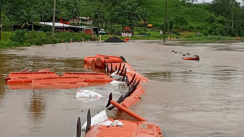
Almost 30 people are currently taking shelter at the Rambisessar Chaudhry Memorial School in Sawani as parts of the area has been flooded.
Advisory Councillor Mahend Prasad Chaudhry says the Waimanu River has burst its bank.
If you are living along low lying areas close to the Waimanu River please take necessary precaution.
Chaudhry has also raised concerns that some people including children are playing in the flooded waters which poses danger to their lives.
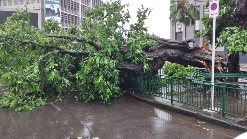
The iconic ivi tree in the heart of Suva City has suffered damages due to TC Ana.
Prime Minister Voreqe Bainimarama says this is one beloved icon we cannot rebuild, with a history we will never replace.
Bainimarama says the tree has stood long before Suva was ever Suva adding it has seen Suva grow from a sleepy colonial outpost into the seat of government of an independent Fiji and the hub of the South Pacific.
He adds that, with proper care, the tree may sprout to its former glory.
Bainimarama says with their commitment to plant 30 million trees, he knows Fijians will grow many more living landmarks that lend us shade, clean our air, beautify our country, and keep our bond with nature strong.
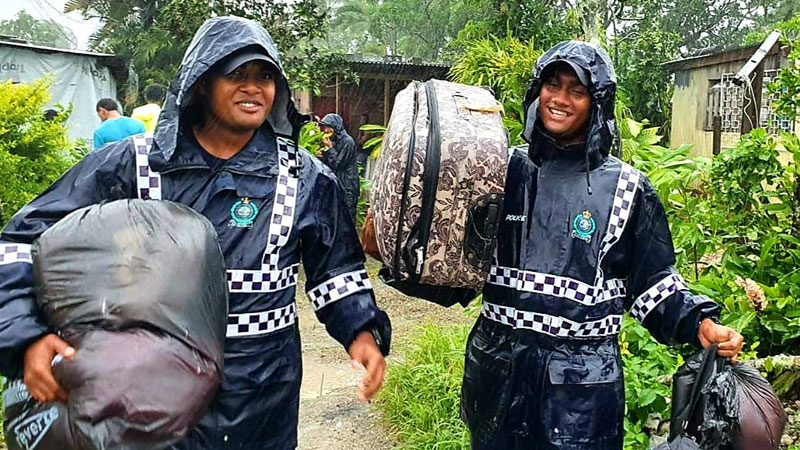
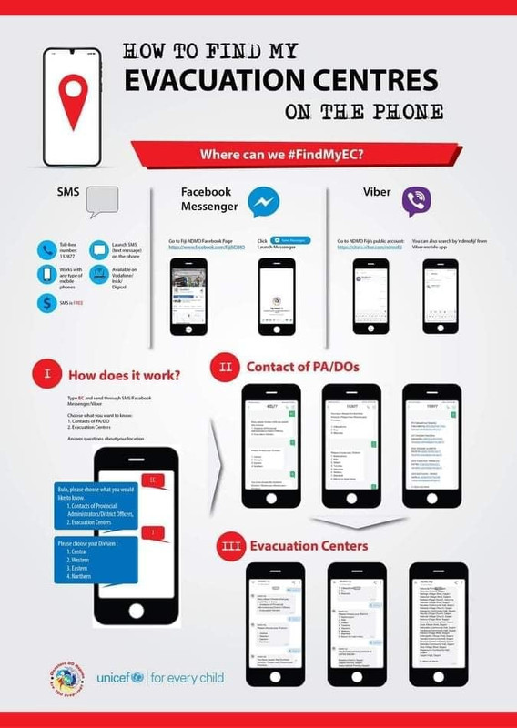
There are 7,612 people are currently taking shelter in 204 evacuation centres around the country.
The National Disaster Management Office says 4,553 people are currently in 105 evacuation centres in the Northern Division.
2,530 people are currently in 75 evacuation centres in the Western Division.
189 people are in 16 evacuation centres in the Central Division while 340 people are in 8 evacuation centres in the Eastern Division.
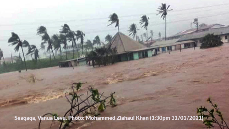
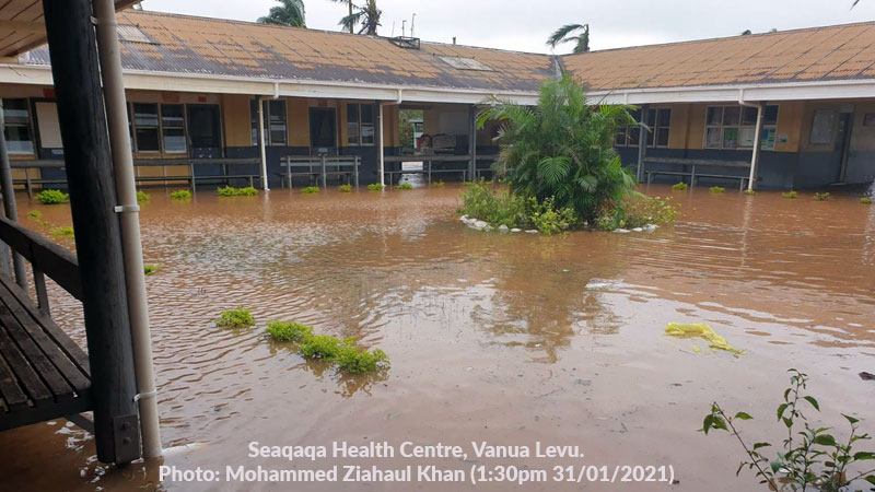
There continues to be severe flash flooding in Seaqaqa in Vanua Levu.
The Seaqaqa Health Centre is now flooded.
Floodwaters also entered the Seaqaqa Police Station earlier this morning.
Many residents leaving in those flooded areas in Seaqaqa have been evacuated by Police.
All students, teachers and staff are to stay at home as schools will remain closed until further notice.
This has been confirmed by the Minister for Education Rosy Akbar who says they will advise the public through a media announcement when schools will reopen as many schools are currently being used as Evacuation Centres.
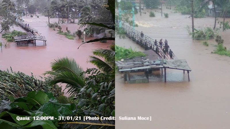
Qauia Village in Lami is currently flooded.
Nasevou Street going into Qauia Vilage is also flooded.
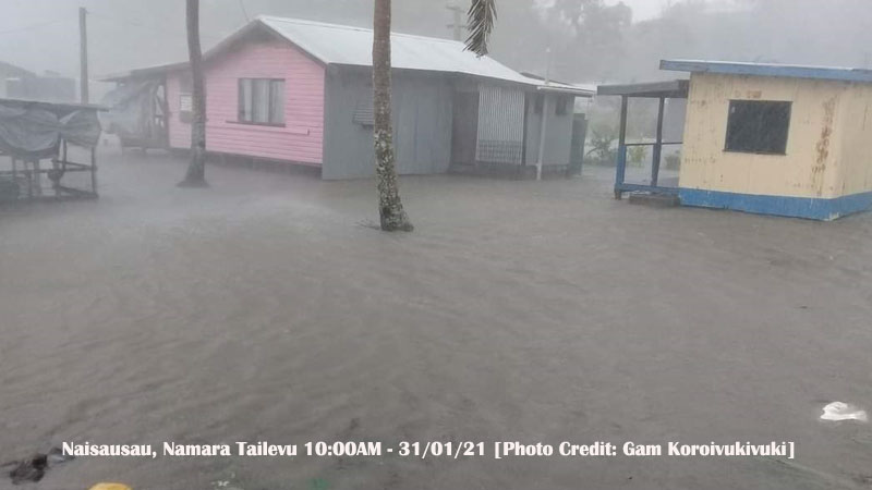
60 homes in Veinuqa Village and 3 homes in Naisausau Village are flooded.
Veinuqa Villager, Semisi Ravutu says the whole village is flooded and they are taking shelter in their community hall and Waidalice District School.
Ravutu says strong winds have also damaged some homes.
Naisausau Villager, Gam Koroivukivuki says 3 homes in their village that are close to the sea are flooded.
Koroivukivuki says villagers whose homes are flooded are taking shelter at their village hall and other homes on higher grounds.
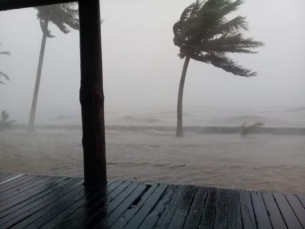

Police officers have continued to help evacuate families who are in need of assistance along the Suva to Nausori Corridor.
Chief of Operations ACP Abdul Khan says the Southern Division Night Owl team rescued a nine month old baby and 2 year old baby last night after a breadfruit tree fell on their house at Khalsa Road.
ACP Khan says they helped conveyed a family to the Evacuation Centre at Tacirua Primary School.
The team also helped families from the Wailea Settlement.
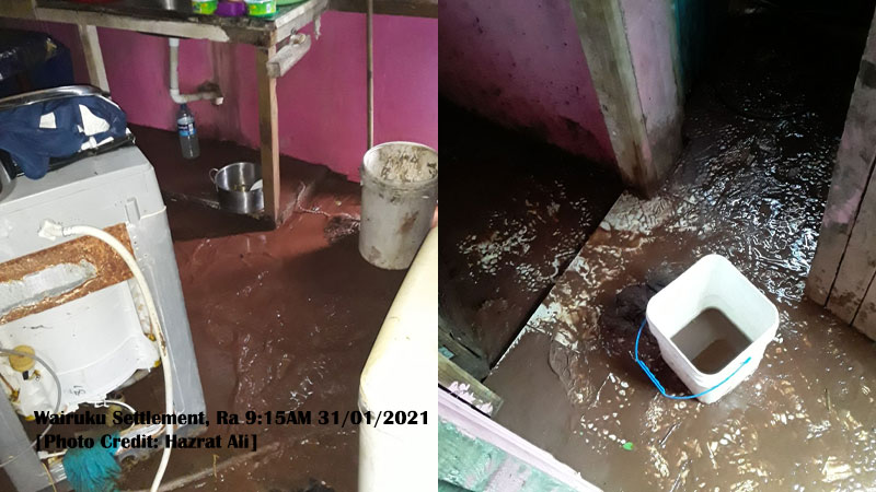
Flood waters have entered about 10 houses in Wairuku Settlement in Rakiraki.
Advisory Councilor, Hazrat Ali says they experienced heavy rain and damaging winds from 1am this morning to around 6am however it is not raining at the moment.
Ali says farmers in the area are disheartened as they lost all their cash crops during TC Yasa and they had just started planting again.
He says they are also facing water disruptions from 11pm last night.
There are about 285 houses in the area.
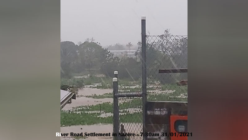
Torrential rain and damaging winds are being faced by residents of River Road in Narere.
They have been facing this since last night.
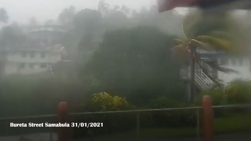
Heavy rain and damaging winds are currently being felt in Suva as TC Ana moves towards the Central Division.
The centre of TC Ana is expected to exit Viti Levu from the Central Division starting from midday today.
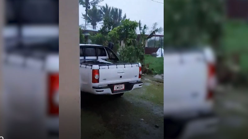
People of Navua are still experiencing damaging to destructive winds which has blown away some weak structures such as barns and sheds.
Resident Ravneel Sharma says they have not experienced such winds in a long time and this has been going on from midnight.
Sharma says they are also experiencing heavy rain and there is a threat of flooding.
Another resident adds they have not been able to sleep all night.
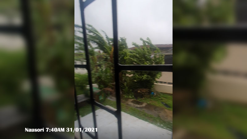
People living in Nausori are facing damaging winds and heavy rain as TC Ana moves towards the Central Division.
Our reporter Dhanjay Deo says that they have been facing damaging winds and heavy rain from about midnight and it has continued into the morning.
Rajesh Chand of Davuilevu Housing says they started facing the strong winds at around 2 this morning.
He says the wind speed has been the same since 2.
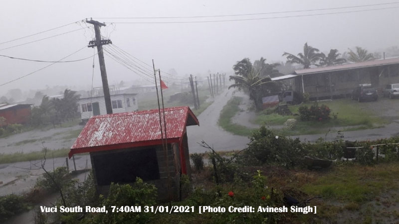
Flood waters are starting to rise in Vuci South Road in Nausori.
Some residents have started leaving their homes to move to homes on higher ground.
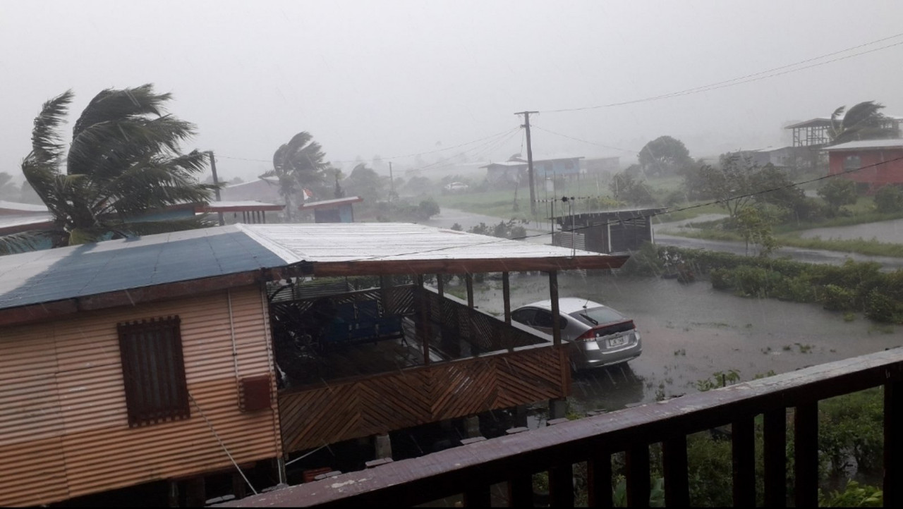
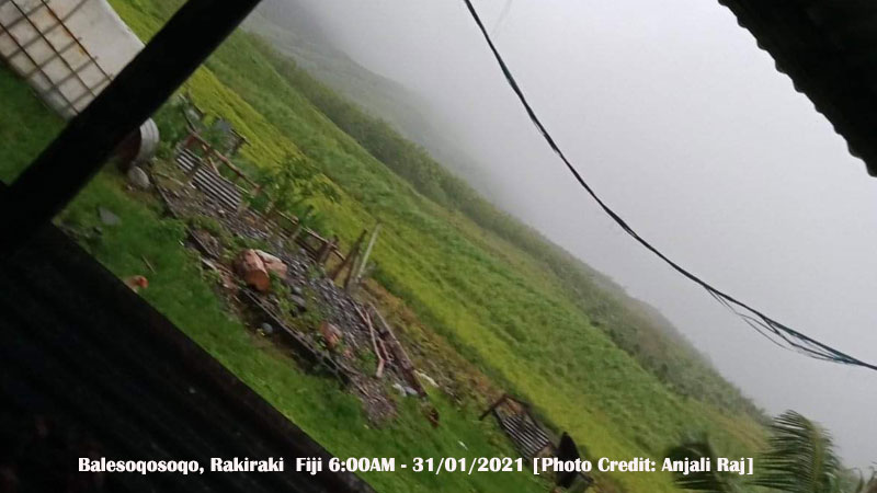
People of Balesoqosoqo in Nalawa Rakiraki experienced heavy rain and damaging winds from 5pm yesterday to 6am this morning.
A resident, Anjali Raj says due to the damaging winds, her kitchen and bulk sustained some damages.
She says many families who live in the low lying areas had moved to the evacuation centres as a precautionary measure.
Raj adds that all the cash crops and sugarcane farms have been destroyed due to the flood.
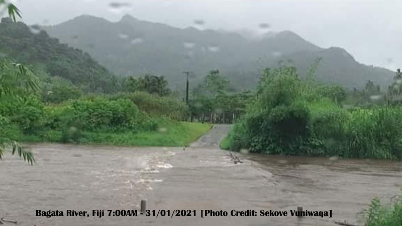
54 families from Bagata Village in Savusavu have moved to their evacuation centres as their homes have been flooded.
Villager, Sekove Vuniwaqa says these families are being sheltered at their village hall and church as parts of the village are flooded.
Vuniwaqa says these villagers homes are close to the Bagata River.
He adds some houses have also been damaged.
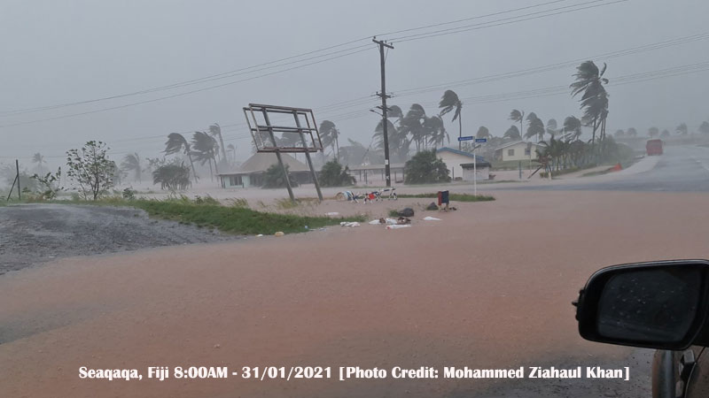
Parts of the town area in Seaqaqa in Labasa is flooded.
Resident Mohammed Ziahaul Khan says he drove past the area at 8 o'clock this morning and flood waters have entered some of the buildings.
Subrail Park in Labasa was also covered with floodwaters at around 6 o'clock this morning.
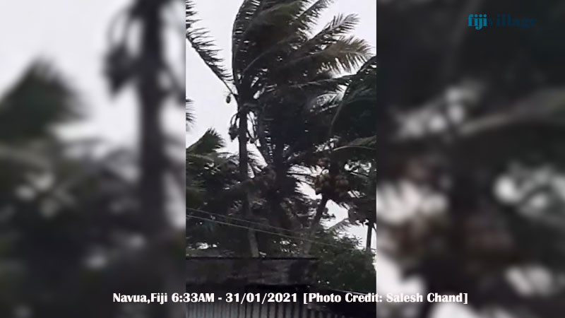
Residents of Navua and Pacific Harbour are now feeling the effects of TC Ana as strong winds and heavy rain is being experienced in their area.
Arvin Prasad of Nasasa Road Navua says they are currently experiencing damaging winds and heavy rain.
Prasad says they are also without power supply.
Pacific Harbour resident, Ajesh Kumar says the situation changed for them around 1 this morning.
Kumar says their house has not sustained any damages.
15 families of Veinuqa Village are taking shelter at Waidalice District School as winds have picked up in Tailevu North.
Villager, Semisi Ravutu says these families started moving to the school from yesterday and early this morning as winds intensified.
Ravutu says they have been experiencing heavy rain and strong winds from 3 o’clock this morning.

People in Ba are experiencing damaging winds being brought by Tropical Cyclone Ana
Anilesh Prasad, a resident of Vunisamaloa, Ba says he was awakened by the sound of the roof shaking due to very strong winds.
Prasad says winds picked up early this morning.
He says it continues to rain very heavily and people are moving to evacuation centres.
A resident of Varadoli Ba says they are also experiencing damaging winds and heavy rain.
Heavy rain and strong winds are now being felt in Suva, Nasinu and Nausori.
We have received reports of strong winds and heavy rain being felt in Samabula, Nabua, Tamavua, Sakoca, Koronivia, Vuci South and River Road.
There are reports of strong winds also being felt in Navua and Pacific Harbour.
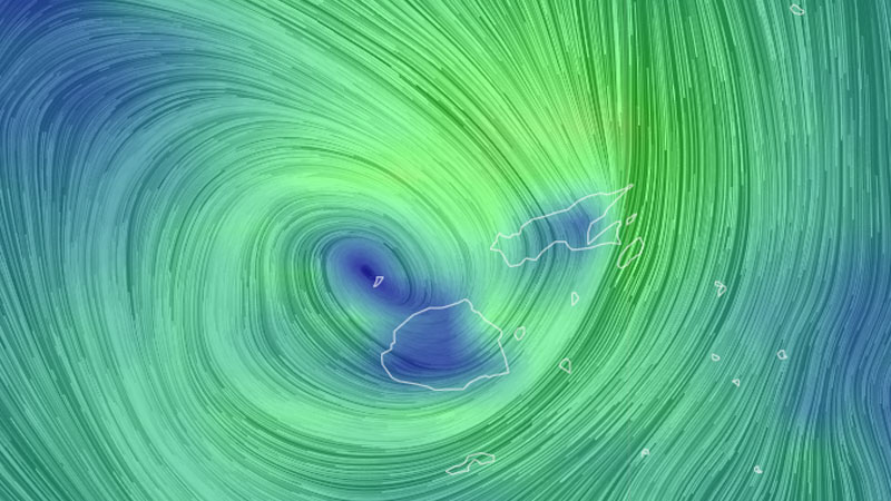
Seaqaqa residents have been facing strong winds and heavy rain from yesterday afternoon.
Imtiyaz Hussein says they have been experiencing this condition since around 4 yesterday afternoon.
Hussein says the situation feels similar to what they went through during TC Yasa.
He adds his home had sustained damaged during TC Yasa.
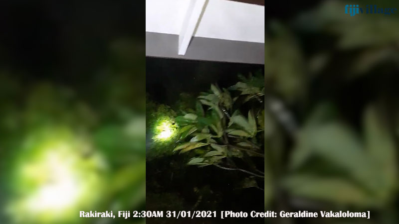
Winds have intensified in Rakiraki.
Golden Point Resort Managing Director, Rachel Mishra says winds are getting stronger and they are also experiencing a lot of rain.
Mishra says majority of the areas in Rakiraki have been without power for the past two days.
She adds people have been preparing themselves as Tropical Cyclone Ana is expected to make landfall in Rakiraki this morning.
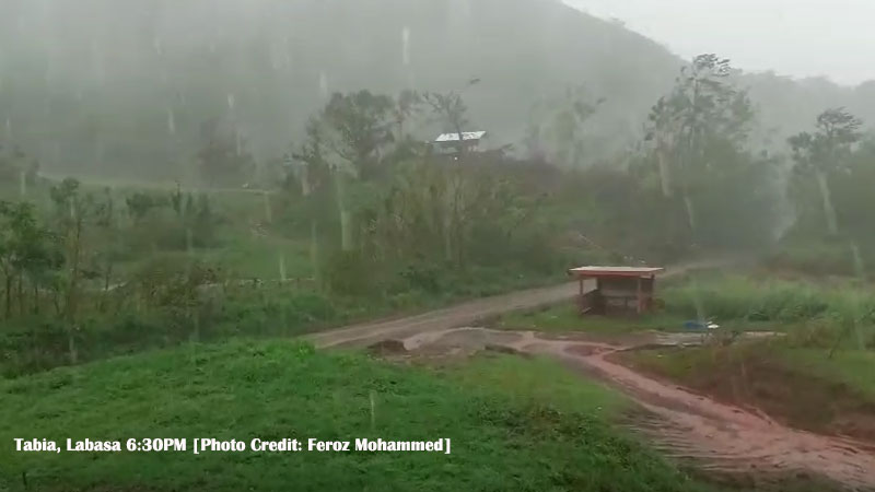
Strong winds and heavy rain are being experienced in the Northern Division.
A resident from Vunivau in Bua, Ramesh Lal says many people who live in low lying areas moved to the evacuation centre as a precautionary measure.
They are also experiencing damaging winds.
Jai Nand from Naleba Labasa says winds have picked up in their area at around 8pm today.
These areas were also affected by TC Yasa last month.
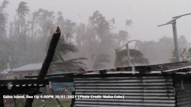
13 families in Galoa Island in Bua whose homes are close to the sea have moved to their evacuation centres.
Galoa Island Primary School teacher, Maika Cabe says they are facing strong winds and heavy rain and these families also faced the risk of high waves.
Cabe says 7 families are taking shelter in their village hall and 6 families are sheltered in the school.
He adds neighbouring islands like Taveya and Yaqaga are also experiencing heavy rain and strong winds.
Galoa Island was severely affected by TC Yasa.
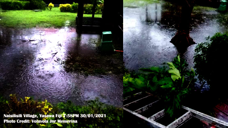
A few homes in Naisilisili Village in Yasawa are flooded due to the continuous heavy rain.
Villager, Mere Volavola says villagers whose homes are flooded have moved to their community hall.
She says movement has been restricted in the village due to flood waters rising and the damaging winds they are also experiencing.

15 families of Barotu Village in Ra have moved to their evacuation centre as they are currently experiencing strong winds and heavy rain.
Advisory Councilor, Harjeet Kaur says there are about 74 homes and those families who live on higher ground are in their homes.
She says they cannot go out at the moment as the area is flooded and vegetable farms are under water.
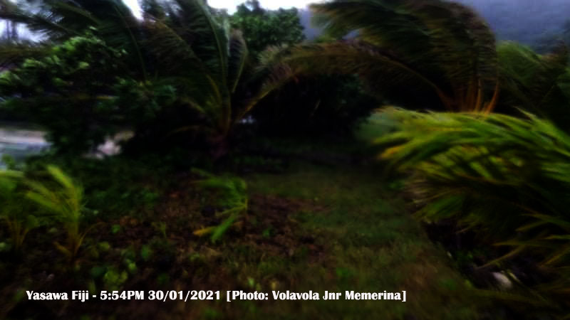
More than 100 villagers of Gunu in Yasawa are taking shelter at their evacuation centre as they are experiencing damaging winds and heavy rain.
Gunu Village Church Steward, Lakai Lesulala says they are taking proactive measures as Tropical Cyclone Ana is expected to be located closer to the Yasawa Group tonight.
Lesulala says they have also secured their homes before moving to their evacuation centre and have prepared food for the whole weekend.
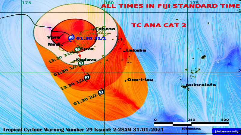
Tropical Cyclone Ana has intensified into a Category 2 Cyclone and the centre is expected to be over the Ba coast shortly and TC Ana will then be covering Viti Levu and continue over landfall. Stay safe.
The Nadi Weather Office says the system has moved to the west from its projected path.
The Nadi Weather Office says the front part of Cyclone Ana is affecting Viti Levu to Kadavu and category 2 damaging winds being experienced will continue for most part of this morning into today.
They say the wind is expected to intensify as the system continues to move over Viti Levu today.
The Weather Office adds the whole of Fiji will experience damaging winds today.
Please note that you will experience damaging winds a few hours before and after the centre of Cyclone Ana passes overhead or nearby.
TC Ana was located about 95 kilometres North East of Nadi at 1.30 this morning.
The Nadi Weather Office says people can expect winds of up to 95 kilometres per hour with momentary gusts of up to 130 kilometres per hour.
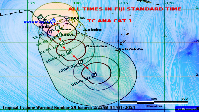
The strong and damaging winds have the potential to destroy weak structures, disrupt electrical power distribution and communication services.
It can also cause severe damage to crops and vegetation.
There is also a heavy rain warning for the whole of Fiji.
Prepare for more widespread heavy rain and flooding.
There is an increased risk of landslides, flash flooding of low lying areas and flooding of streams and rivers as the ground is already saturated.
A flash flood warning remains in force for all low lying areas and small streams near major rivers of Viti Levu and Vanua Levu.
You can also contact Police on 917, the National Fire Authority on 910, Energy Fiji Limited on 913, Water Authority on 5777 and FRA on 5720.

Category 1 Tropical Cyclone Ana is likely to make landfall over the Ra Province this morning and then continue to move southeastwards over Viti Levu and cross the Central Division today.
This is based on the current projection of the Nadi Weather Office.
The Nadi Weather Office says the whole of Fiji will experience damaging winds today.
Please note that you will experience damaging winds a few hours before and after the centre of Cyclone Ana passes overhead or nearby.
The eye of TC Ana is still located close to Yasawa while a Tropical Cyclone warning remains in force for Fiji.
TC Ana was located about 130 kilometres North of Nadi at 9 last night.
The Nadi Weather Office says people can expect winds of up to 85 kilometres per hour with momentary gusts of up to 120 kilometres per hour.
The strong and damaging winds have the potential to destroy weak structures, disrupt electrical power distribution and communication services.

It can also cause severe damage to crops and vegetation.
There is also a heavy rain warning for the whole of Fiji.
Prepare for more widespread heavy rain and flooding.
There is an increased risk of landslides, flash flooding of low lying areas and flooding of streams and rivers as the ground is already saturated.
If you live along with the coastal areas of Viti Levu, Vanua Levu, Yasawa and Mamanuca, please note that Cyclone Ana can bring high waves of possibly more than 6 metres.
A flash flood warning remains in force for all low lying areas and small streams near major rivers of Viti Levu and Vanua Levu.
Areas included in the flash flood warning for Vanua Levu are Nabouwalu to Labasa, Nabouwalu to Kubulau, Dawara to Naibalebale Village along Wailevu West Coast Road, Naibalebale Village to Savusavu, Savusavu to Natewa and Tunuloa, Koroalau, Saqani to Labasa.
Areas included in the flash flood warning for Viti Levu are low lying areas from Sigatoka to Lautoka to Rakiraki – Semo in Nadroga, Nawaicoba, Nadi Back Road, Lomolomo and Barara flats, Navutu flats, Lovu, Saru Back Road, Vuda Back Road in Lautoka, Koronubu flat, Namosau, Veisaru, Varavu flats, Nailaga and other low lying areas in Ba, Nausori, Naqali, Lodoni and Korovou.
You can also contact Police on 917, the National Fire Authority on 910, Energy Fiji Limited on 913, Water Authority on 5777 and FRA on 5720.
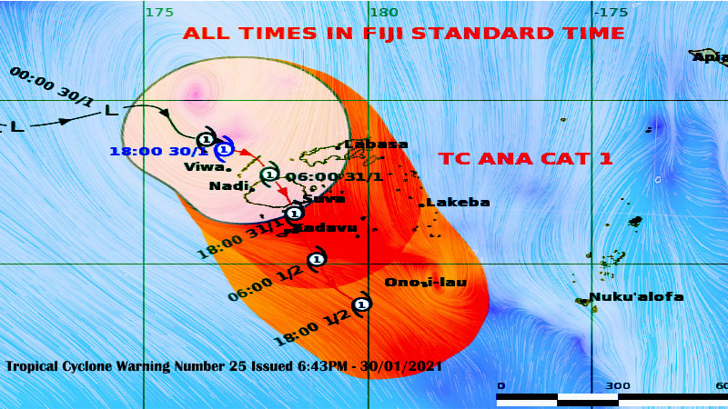
The eye of Category 1 Tropical Cyclone Ana is still located close to Yasawa while a Tropical Cyclone warning remains in force for Fiji.
The Nadi Weather Office says based on their current projections, TC Ana is likely to make landfall over the Ra Province around early tomorrow morning and then continue to move southeastwards over Viti Levu and track close to Kadavu around tomorrow night to Monday morning.
Please note that you will experience damaging winds a few hours before the centre of Cyclone Ana passes overhead or nearby.
There is also a heavy rain warning for the whole of Fiji.
The Nadi Weather Office says people can expect winds of up to 85 kilometres per hour with momentary gusts of up to 120 kilometres per hour.
TC Ana was located about 130 kilometres North of Nadi at 9 tonight.

The strong and damaging winds have the potential to destroy weak structures, disrupt electrical power distribution and communication services.
It can also cause severe damage to crops and vegetation.
Prepare for more widespread heavy rain and flooding. There is an increased risk of landslides, flash flooding of low lying areas and flooding of streams and rivers as the ground is already saturated.
If you live along with the coastal areas of Viti Levu, Vanua Levu, Yasawa and Mamanuca, please note that Cyclone Ana can bring high waves of possibly more than 6 metres.
A flash flood warning remains in force for all low lying areas and small streams near major rivers of Viti Levu and Vanua Levu.
Areas included in the flash flood warning for Vanua Levu are Nabouwalu to Labasa, Nabouwalu to Kubulau, Dawara to Naibalebale Village along Wailevu West Coast Road, Naibalebale Village to Savusavu, Savusavu to Natewa and Tunuloa, Koroalau, Saqani to Labasa.
Areas included in the flash flood warning for Viti Levu are low lying areas from Sigatoka to Lautoka to Rakiraki – Semo in Nadroga, Nawaicoba, Nadi Back Road, Lomolomo and Barara flats, Navutu flats, Lovu, Saru Back Road, Vuda Back Road in Lautoka, Koronubu flat, Namosau, Veisaru, Varavu flats, Nailaga and other low lying areas in Ba, Nausori, Naqali, Lodoni and Korovou.
You can also contact Police on 917, the National Fire Authority on 910, Energy Fiji Limited on 913, Water Authority on 5777 and FRA on 5720.
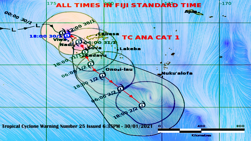
The eye of Tropical Cyclone Ana is expected to be located closer to the Yasawa group tonight and approach Viti Levu early tomorrow as a Category 1 cyclone.
The Nadi Weather Office says Tropical Cyclone Ana is likely to make landfall over the Ra Province around tomorrow morning then continue to move southeastwards over Viti Levu and track close to Kadavu around tomorrow night to Monday morning.
You will experience damaging winds a few hours before the centre of Cyclone Ana passes overhead or nearby.
The Nadi Weather Office says they are getting reports from the ground that strong winds are already being experienced in Yasawa.
The system was located 200 kilometres North West of Nadi earlier today.
Category 1 Tropical Cyclone Ana is currently moving East at about 20 kilometres per hour.

Prepare for more widespread heavy rain and flooding.
You should expect winds of up to 65 kilometres per hour with momentary gusts of up to 90 kilometres per hour.
The strong and damaging winds have the potential to destroy weak structures, disrupt electrical power distribution and communication services.
It can also cause severe damage to crops and vegetation.
There is an increased risk of landslides, flash flooding of low lying areas and flooding of streams and rivers as the ground is already saturated.
If you live along with the coastal areas of Viti Levu, Vanua Levu, Yasawa and Mamanuca, please note that Cyclone Ana can bring high waves of possibly more than 6 metres.
A flash flood warning remains in force for all low lying areas and small streams near major rivers of Viti Levu and Vanua Levu.
Areas included in the flash flood warning for Vanua Levu are Nabouwalu to Labasa, Nabouwalu to Kubulau, Dawara to Naibalebale Village along Wailevu West Coast Road, Naibalebale Village to Savusavu, Savusavu to Natewa and Tunuloa, Koroalau, Saqani to Labasa.
Areas included in the flash flood warning for Viti Levu are low lying areas from Sigatoka to Lautoka to Rakiraki – Semo in Nadroga, Nawaicoba, Nadi Back Road, Lomolomo and Barara flats, Navutu flats, Lovu, Saru Back Road, Vuda Back Road in Lautoka, Koronubu flat, Namosau, Veisaru, Varavu flats, Nailaga and other low lying areas in Ba, Nausori, Naqali, Lodoni and Korovou.
A Tropical Cyclone warning remains in force for the whole of Fiji.
There is also a heavy rain warning for the whole of Fiji.
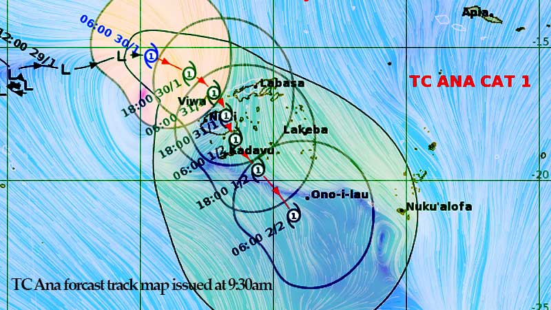
The eye of Tropical Cyclone Ana is expected to be located closer to the Yasawa group tonight and approach Viti Levu early tomorrow as a Category 1 cyclone.
The Nadi Weather Office says Tropical Cyclone Ana is likely to make landfall over the Ra Province around tomorrow morning then continue to move southeastwards over Viti Levu and track close to Kadavu around tomorrow night to Monday morning.
You will experience damaging winds from later this afternoon before the centre of Cyclone Ana passes over overhead or nearby.
The Nadi Weather Office says they are getting reports from the ground that strong winds are already being experienced in Yasawa.
The system was located 200 kilometres North West of Nadi earlier today.
Category 1 Tropical Cyclone Ana is currently moving East at about 20 kilometres per hour.
Prepare for more widespread heavy rain and flooding.
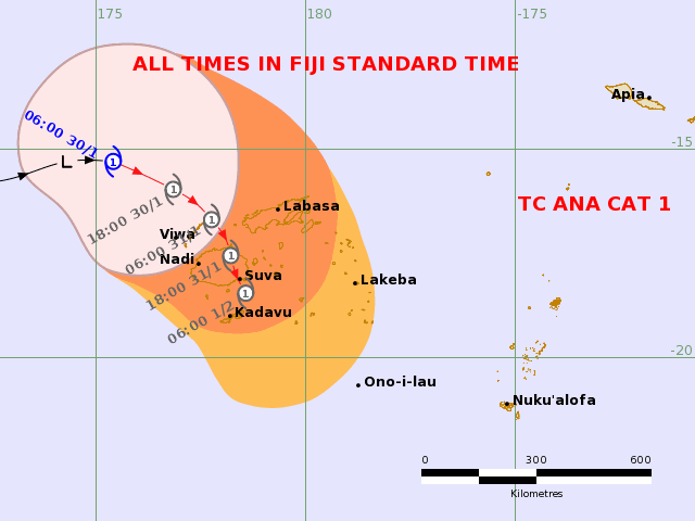
You should expect winds of up to 65 kilometres per hour with momentary gusts of up to 90 kilometres per hour.
The strong and damaging winds have the potential to destroy weak structures, disrupt electrical power distribution and communication services.
It can also cause severe damage to crops and vegetation.
There is an increased risk of landslides, flash flooding of low lying areas and flooding of streams and rivers as the ground is already saturated.
If you live along with the coastal areas of Viti Levu, Vanua Levu, Yasawa and Mamanuca, please note that Cyclone Ana can bring high waves of possibly more than 6 metres.
A flash flood warning remains in force for all low lying areas and small streams near major rivers of Viti Levu and Vanua Levu.
Areas included in the flash flood warning for Vanua Levu are Nabouwalu to Labasa, Nabouwalu to Kubulau, Dawara to Naibalebale Village along Wailevu West Coast Road, Naibalebale Village to Savusavu, Savusavu to Natewa and Tunuloa, Koroalau, Saqani to Labasa.
Areas included in the flash flood warning for Viti Levu are low lying areas from Sigatoka to Lautoka to Rakiraki – Semo in Nadroga, Nawaicoba, Nadi Back Road, Lomolomo and Barara flats, Navutu flats, Lovu, Saru Back Road, Vuda Back Road in Lautoka, Koronubu flat, Namosau, Veisaru, Varavu flats, Nailaga and other low lying areas in Ba, Nausori, Naqali, Lodoni and Korovou.
A Tropical Cyclone warning remains in force for the whole of Fiji.
There is also a heavy rain warning for the whole of Fiji.
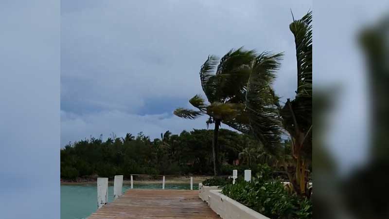
Yasawa-i-rara villagers are starting to experience heavy rain and strong winds as Category 1 Tropical Cyclone Ana moves closer to the Fiji group.
Kitione Talai of Yasawa-i-rara village says they started experiencing heavy rain and strong winds from 8 o'clock this morning.
He says they have prepared two evacuation centres in the village and those villagers close to the school will evacuate to the school if the weather intensifies.
Talai says there are also rough seas.

The eye of Tropical Cyclone Ana is expected to be located closer to the Yasawa group tonight and approach Viti Levu early tomorrow as a Category 1 cyclone.
The Nadi Weather Office says Tropical Cyclone Ana is likely to make landfall over the Ra Province around tomorrow morning then continue to move southeastwards over Viti Levu and track close to Kadavu around tomorrow night to Monday morning.
You will experience damaging winds from later this afternoon before the centre of Cyclone Ana passes over overhead or nearby.
The Nadi Weather Office says they are getting reports from the ground that strong winds are already being experienced in Yasawa.
The system was located 200 kilometres North West of Nadi earlier today.
Category 1 Tropical Cyclone Ana is currently moving East at about 20 kilometres per hour.
Prepare for more widespread heavy rain and flooding.

You should expect winds of up to 65 kilometres per hour with momentary gusts of up to 90 kilometres per hour.
The strong and damaging winds have the potential to destroy weak structures, disrupt electrical power distribution and communication services.
It can also cause severe damage to crops and vegetation.
There is an increased risk of landslides, flash flooding of low lying areas and flooding of streams and rivers as the ground is already saturated.
If you live along with the coastal areas of Viti Levu, Vanua Levu, Yasawa and Mamanuca, please note that Cyclone Ana can bring high waves of possibly more than 6 metres.
A flash flood warning remains in force for all low lying areas and small streams near major rivers of Viti Levu and Vanua Levu.
Areas included in the flash flood warning for Vanua Levu are Nabouwalu to Labasa, Nabouwalu to Kubulau, Dawara to Naibalebale Village along Wailevu West Coast Road, Naibalebale Village to Savusavu, Savusavu to Natewa and Tunuloa, Koroalau, Saqani to Labasa.
Areas included in the flash flood warning for Viti Levu are low lying areas from Sigatoka to Lautoka to Rakiraki – Semo in Nadroga, Nawaicoba, Nadi Back Road, Lomolomo and Barara flats, Navutu flats, Lovu, Saru Back Road, Vuda Back Road in Lautoka, Koronubu flat, Namosau, Veisaru, Varavu flats, Nailaga and other low lying areas in Ba, Nausori, Naqali, Lodoni and Korovou.
A Tropical Cyclone warning remains in force for the whole of Fiji.
There is also a heavy rain warning for the whole of Fiji.
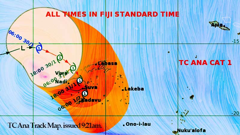
You will experience damaging winds from later this afternoon before the centre of Category 1 Tropical Cyclone Ana passes over overhead or nearby.
The Nadi Weather Office says they are getting reports from the ground that strong winds are already being experienced in Yasawa.
The system was located 210 kilometres North West of Nadi earlier this morning.
Category 1 Tropical Cyclone Ana is currently moving East at about 20 kilometres per hour.
Based on the current projections by the Nadi Weather Office, the centre of the cyclone is expected to pass over the Yasawa and Mamanuca Group later this afternoon.
The Nadi Weather Office says the centre is also expected to pass over Viti Levu late this evening into tomorrow morning.
Prepare for more widespread heavy rain and flooding.
You should expect winds of up to 65 kilometres per hour with momentary gusts of up to 90 kilometres per hour.
The strong and damaging winds have the potential to destroy weak structures, disrupt electrical power distribution and communication services.
It can also cause severe damage to crops and vegetation.
There is an increased risk of landslides, flash flooding of low lying areas and flooding of streams and rivers as the ground is already saturated.
If you live along with the coastal areas of Viti Levu, Vanua Levu, Yasawa and Mamanuca, please note that Cyclone Ana can bring high waves of possibly more than 6 metres.
A flash flood warning remains in force for all low lying areas and small streams near major rivers of Viti Levu and Vanua Levu.
Areas included in the flash flood warning for Vanua Levu are Nabouwalu to Labasa, Nabouwalu to Kubulau, Dawara to Naibalebale Village along Wailevu West Coast Road, Naibalebale Village to Savusavu, Savusavu to Natewa and Tunuloa, Koroalau, Saqani to Labasa.
Areas included in the flash flood warning for Viti Levu are low lying areas from Sigatoka to Lautoka to Rakiraki – Semo in Nadroga, Nawaicoba, Nadi Back Road, Lomolomo and Barara flats, Navutu flats, Lovu, Saru Back Road, Vuda Back Road in Lautoka, Koronubu flat, Namosau, Veisaru, Varavu flats, Nailaga and other low lying areas in Ba, Nausori, Naqali, Lodoni and Korovou.
A Tropical Cyclone warning remains in force for the whole of Fiji. There is also a heavy rain warning for the whole of Fiji.

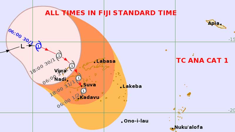
You should prepare for more widespread heavy rain, flooding and damaging winds as Tropical Depression 05F has intensified into Category 1 Tropical Cyclone Ana and continues to track towards Fiji.
The Nadi Weather Office says the system developed into a Category 1 Cyclone earlier this morning and it was located about 350 kilometres North West of Nadi.
Based on the current projections by the Nadi Weather Office, the centre of the cyclone is expected to pass over the Yasawa and Mamanuca Group later this afternoon.
The Nadi Weather Office says the centre is also expected to pass over Viti Levu late this evening into tomorrow morning.
[Image: Fiji Met]
You should prepare now as damaging winds are likely to begin several hours before the cyclone centre passes overhead or nearby.
The Weather Office says the system is currently moving East at about 20 kilometres per hour.
People can expect winds of up to 65 kilometers per hour with momentary gusts of up to 90 kilometres per hour from today.
The gale force and strong winds has the potential to cause destruction to weak structures, disruption of electrical power distribution and communication services.
It can also cause severe damage to crops and vegetation.
With the ground already saturated and more rain forecast, there is increased risk of landslides, flash flooding of low lying areas and flooding of streams and rivers.
Stay away from flooded drains, streams and rivers while drivers are requested to take extreme care as there is a risk of poor visibility in areas of heavy rain and thunderstorms.
As Cyclone Ana moves closer towards the group, it can bring high waves of possibly more than 6 metres which poses the risk of possible high waves and coastal inundation along coastlines especially over Viti Levu, Vanua Levu, Yasawa and Mamanuca. The high waves will be enhanced during high tides.
Sea conditions will be too dangerous for sailing and other sea activities.
A flash flood warning remains in force for all low lying areas and small streams near major rivers of Viti Levu and Vanua Levu.
Areas included in the flash flood warning for Vanua Levu are Nabouwalu to Labasa, Nabouwalu to Kubulau, Dawara to Naibalebale Village along Wailevu West Coast Road, Naibalebale Village to Savusavu, Savusavu to Natewa and Tunuloa, Koroalau, Saqani to Labasa.
Areas included in the flash flood warning for Viti Levu are low lying areas from Sigatoka to Lautoka to Rakiraki – Semo in Nadroga, Nawaicoba, Nadi Back Road, Lomolomo and Barara flats, Navutu flats, Lovu, Saru Back Road, Vuda Back Road in Lautoka, Koronubu flat, Namosau, Veisaru, Varavu flats, Nailaga and other low lying areas in Ba, Nausori, Naqali, Lodoni and Korovou.

Tropical Depression 05F continues to track towards Fiji and was located at about 430 kilometers North West of Nadi at 3 this morning.
A Tropical Cyclone Warning remains in force for Fiji.
Be ready for widespread heavy rain, flooding and damaging winds as TDO5F is expected to develop into a cyclone as it heads towards Fiji.
The Nadi Weather Office says based on the current projections the centre of the potential cyclone is expected to pass over the Yasawa and Mamanuca Group later this afternoon.
They say the centre is also expected to pass over Viti Levu.
Please be advised that damaging winds are likely to begin several hours before the cyclone centre passes overhead or nearby.
A heavy rain and strong wind warning remains in place for Fiji.
The Weather Office says the system is currently moving East North East at about 18 kilometres per hour.
People can expect winds of up to 65 kilometers per hour with momentary gusts of up to 90 kilometres per hour from today.

The gale force and strong winds has the potential to cause destruction to weak structures, disruption of electrical power distribution and communication services.
It can also cause severe damage to crops and vegetation.
With the ground already saturated and more rain forecast, there is increased risk of landslides, flash flooding of low lying areas and flooding of streams and rivers.
If you are living in flood and landslide prone areas, remain alert and take precautions now.
Stay away from flooded drains, streams and rivers while drivers are requested to take extreme care as there is a risk of poor visibility in areas of heavy rain and thunderstorms.
TD05F which may possibly be a cyclone as it moves closer towards the group, can bring high waves of possibly more than 6 metres which poses the risk of possible high waves and coastal inundation along coastlines especially over Viti Levu, Vanua Levu, Yasawa and Mamanuca. The high waves will be enhanced during high tides.
Sea conditions will be too dangerous for sailing and other sea activities.
A flash flood warning remains in force for all low lying areas and small streams near major rivers of Viti Levu and Vanua Levu.
Areas included in the flash flood warning for Vanua Levu are Nabouwalu to Labasa, Nabouwalu to Kubulau, Dawara to Naibalebale Village along Wailevu West Coast Road, Naibalebale Village to Savusavu, Savusavu to Natewa and Tunuloa, Koroalau, Saqani to Labasa.
Areas included in the flash flood warning for Viti Levu are low lying areas from Sigatoka to Lautoka to Rakiraki – Semo in Nadroga, Nawaicoba, Nadi Back Road, Lomolomo and Barara flats, Navutu flats, Lovu, Saru Back Road, Vuda Back Road in Lautoka, Koronubu flat, Namosau, Veisaru, Varavu flats, Nailaga and other low lying areas in Ba, Nausori, Naqali, Lodoni and Korovou.
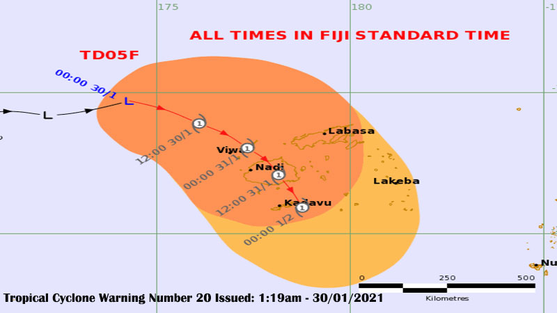
A Tropical Cyclone Warning remains in force for Fiji as Tropical Depression 05F is located 430 kilometres North West of Nadi.
The Nadi Weather Office says based on the current projections the centre of the potential cyclone is expected to pass over the Yasawa and Mamanuca Group later this afternoon.
They say the centre is also expected to pass over Viti Levu.
Please be advised that damaging winds are likely to begin several hours before the cyclone centre passes overhead or nearby.
Be ready for widespread heavy rain, flooding and damaging winds as TDO5F is expected to develop into a cyclone as it heads towards Fiji.
A heavy rain and strong wind warning remains in place for Fiji.
The Weather Office says the system is currently moving East at about 24 kilometres per hour and is expected to track South East and move towards Fiji.
People can expect winds of up to 65 kilometers per hour with momentary gusts of up to 90 kilometres per hour from today.
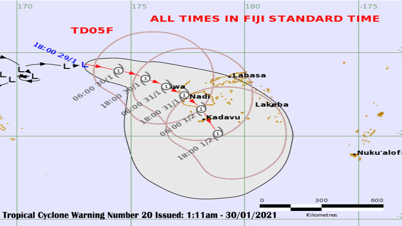
The gale force and strong winds has the potential to cause destruction to weak structures, disruption of electrical power distribution and communication services.
It can also cause severe damage to crops and vegetation.
With the ground already saturated and more rain forecast, there is increased risk of landslides, flash flooding of low lying areas and flooding of streams and rivers.
If you are living in flood and landslide-prone areas, remain alert and take precautions now.
Stay away from flooded drains, streams and rivers while drivers are requested to take extreme care as there is a risk of poor visibility in areas of heavy rain and thunderstorms.
TD05F which may possibly be a cyclone as it moves closer towards the group, can bring high waves of possibly more than 6 metres which poses the risk of possible high waves and coastal inundation along coastlines especially over Viti Levu, Vanua Levu, Yasawa and Mamanuca. The high waves will be enhanced during high tides.
Sea conditions will be too dangerous for sailing and other sea activities.
A flash flood warning remains in force for all low lying areas and small streams near major rivers of Viti Levu and Vanua Levu.
Areas included in the flash flood warning for Vanua Levu are Nabouwalu to Labasa, Nabouwalu to Kubulau, Dawara to Naibalebale Village along Wailevu West Coast Road, Naibalebale Village to Savusavu, Savusavu to Natewa and Tunuloa, Koroalau, Saqani to Labasa.
Areas included in the flash flood warning for Viti Levu are low lying areas from Sigatoka to Lautoka to Rakiraki – Semo in Nadroga, Nawaicoba, Nadi Back Road, Lomolomo and Barara flats, Navutu flats, Lovu, Saru Back Road, Vuda Back Road in Lautoka, Koronubu flat, Namosau, Veisaru, Varavu flats, Nailaga and other low lying areas in Ba, Nausori, Naqali, Lodoni and Korovou.

A Tropical Cyclone Warning remains in force for Fiji as Tropical Depression 05F is located 530 kilometres West North West of Nadi.
Be ready for widespread heavy rain, flooding and damaging winds as TDO5F is expected to develop into a cyclone early tomorrow as it heads towards Fiji.
A heavy rain and strong wind warning remains in place for Fiji.
The Nadi Weather Office says the system is currently moving East at about 13 kilometres per hour and is expected to track South East towards Fiji in the next 24 hours.
They say people can expect winds of up to 95 kilometres per hour from tonight.
The gale force and strong winds has the potential to cause destruction to weak structures, disruption of electrical power distribution and communication services.
It can also cause severe damage to crops and vegetation.
With the ground already saturated and more rain forecast, there is increased risk of landslides, flash flooding of low lying areas and flooding of streams and rivers.
If you are living in flood and landslide prone areas, remain alert and take precautions now.

Stay away from flooded drains, streams and rivers while drivers are requested to take extreme care as there is a risk of poor visibility in areas of heavy rain and thunderstorms.
TD05F which may possibly be a cyclone as it moves closer towards the group, can bring high waves of possibly more than 6 metres which poses the risk of possible high waves and coastal inundation along coastlines especially over Viti Levu, Vanua Levu, Yasawa and Mamanuca. The high waves will be enhanced during high tides.
Sea conditions will be too dangerous for sailing and other sea activities.
A flash flood warning remains in force for all low lying areas and small streams near major rivers of Viti Levu and Vanua Levu.
A flood warning remains in force for low lying areas, small streams next to and areas adjacent to and downstream of Qawa River in Vanua Levu, Nakauvadra and Penang rivers in Rakiraki, Nasivi River in Tavua, Matawalu and Vitogo rivers in Lautoka, Elevuka Creek, Navala and Ba River and Semo River in Sigatoka.
Areas that are already flooded include small streams next to Qawa River, Dreketilailai, Boubale and Urata crossings, Korovou flats between Tavua Town and Nadarivatu Junction, Ba Town and Rakiraki Town.
A Flood Alert is now in force for low lying areas and small creeks and streams next to and downstream of Keiyasi, Sigatoka, Nadi and Navua rivers.
Areas included in the flash flood warning for Vanua Levu are Nabouwalu to Labasa, Nabouwalu to Kubulau, Dawara to Naibalebale Village along Wailevu West Coast Road, Naibalebale Village to Savusavu, Savusavu to Natewa and Tunuloa, Koroalau, Saqani to Labasa.
Areas included in the flash flood warning for Viti Levu are low lying areas from Sigatoka to Lautoka to Rakiraki – Semo in Nadroga, Nawaicoba, Nadi Back Road, Lomolomo and Barara flats, Navutu flats, Lovu, Saru Back Road, Vuda Back Road in Lautoka, Koronubu flat, Namosau, Veisaru, Varavu flats, Nailaga and other low lying areas in Ba.
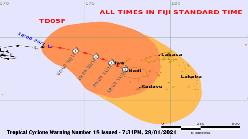
Be ready for widespread heavy rain, flooding and damaging winds as Tropical Depression 05F is expected to develop into a cyclone early tomorrow as it heads towards Fiji.
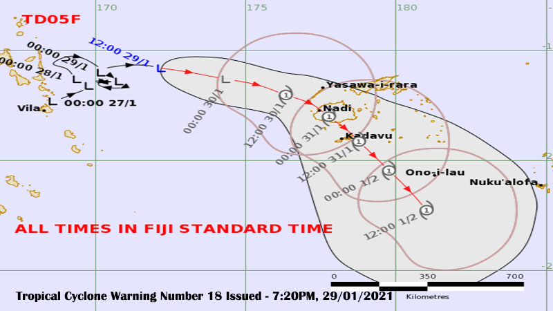
TDO5F is located midway between Fiji and Vanuatu or about 550 kilometres West North West of Nadi.
The Nadi Weather Office says the system is currently moving North East at about 15 kilometres per hour and is expected to track South East towards Fiji in the next 24 hours.
On its anticipated development and track, the system may bring damaging winds over Yasawa Group and the Northern Division early tomorrow. Expect strong winds over the rest of the Fiji Group which may increase to damaging winds from later tomorrow.
The gale force and strong winds has the potential to cause destruction to weak structures, disruption of electrical power distribution and communication services.
It can also cause severe damage to crops and vegetation.
With the ground already saturated and more rain forecast, there is increased risk of landslides, flash flooding of low lying areas and flooding of streams and rivers.
If you are living in flood and landslide prone areas, remain alert and take precautions now.
Stay away from flooded drains, streams and rivers while drivers are requested to take extreme care as there is a risk of poor visibility in areas of heavy rain and thunderstorms.
TD05F which may possibly be a cyclone as it moves closer towards the group, can bring high waves of possibly more than 6 metres which poses the risk of possible high waves and coastal inundation along coastlines especially over Viti Levu, Vanua Levu, Yasawa and Mamanuca. The high waves will be enhanced during high tides.
Sea conditions will be too dangerous for sailing and other sea activities.
A Tropical Cyclone Warning is in force for the whole of Fiji.
A flash flood warning remains in force for all low lying areas and small streams near major rivers of Viti Levu and Vanua Levu.
A flood warning remains in force for low lying areas, small streams next to and areas adjacent to and downstream of Qawa River in Vanua Levu, Nakauvadra and Penang rivers in Rakiraki, Nasivi River in Tavua, Matawalu and Vitogo rivers in Lautoka, Elevuka Creek, Navala and Ba River and Semo River in Sigatoka.
Areas that are already flooded include small streams next to Qawa River, Dreketilailai, Boubale and Urata crossings, Korovou flats between Tavua Town and Nadarivatu Junction, Ba Town and Rakiraki Town.
A Flood Alert is now in force for low lying areas and small creeks and streams next to and downstream of Keiyasi, Sigatoka, Nadi and Navua rivers.
Areas included in the flash flood warning for Vanua Levu are Nabouwalu to Labasa, Nabouwalu to Kubulau, Dawara to Naibalebale Village along Wailevu West Coast Road, Naibalebale Village to Savusavu, Savusavu to Natewa and Tunuloa, Koroalau, Saqani to Labasa.
Areas included in the flash flood warning for Viti Levu are low lying areas from Sigatoka to Lautoka to Rakiraki – Semo in Nadroga, Nawaicoba, Nadi Back Road, Lomolomo and Barara flats, Navutu flats, Lovu, Saru Back Road, Vuda Back Road in Lautoka, Koronubu flat, Namosau, Veisaru, Varavu flats, Nailaga and other low lying areas in Ba.
A heavy rain warning also remains in force for Viti Levu, Vanua Levu, Taveuni and nearby smaller islands, Yasawa and Northern Lau Group and is now in force for the rest of Fiji.
If you are in the Western Division, the Divisional Police Commander is urging you to remain indoors or move to high ground and he is also calling on people not to travel between Sigatoka and Rakiraki as a number of roads are flooded.
SSP Surend Sami says torrential rain from last night has caused widespread flooding in various areas in Sigatoka, Nadi, Lautoka, Ba, Tavua and Rakiraki.
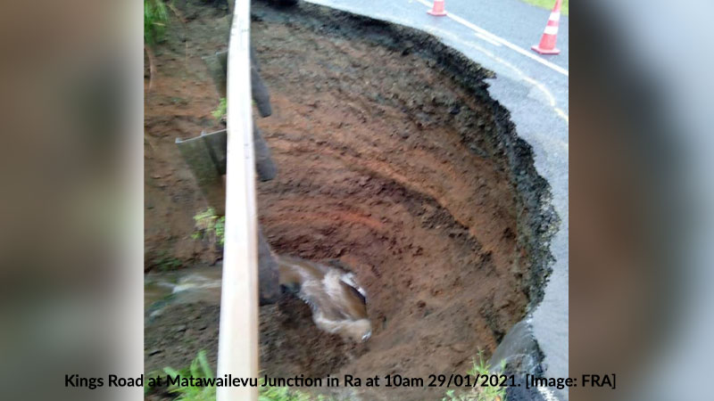
Sami says there have been landslides at Matawailevu on Kings Road and Nukuloa Feeder Road in Ra.
He says there are 297 people currently taking shelter at 11 evacuation centres in the West.
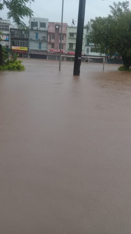
Ba flooding at 4pm today
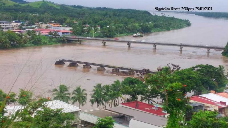
Flood waters have reached some villages which are situated near the Sigatoka River bank.
One of them is Yavulo Village.
This is according to the Sigatoka Police Station who say the villagers are now moving to higher ground.
The water level in Sigatoka River is rising.
A number of roads and bridges in Sigatoka are now flooded.
These areas include Nadromai, Lawai, Raiwaqa, Kavanagasau, Tobotobo, Laqere and Tavuto.
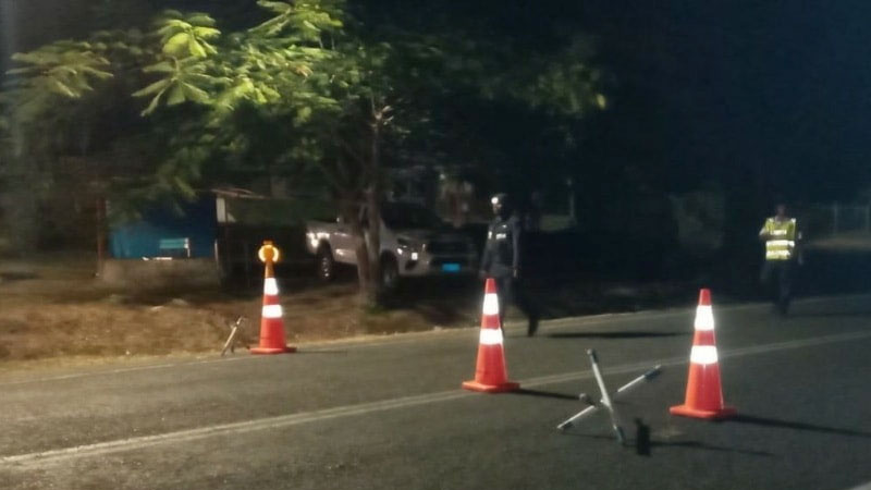
There is no decision on an earlier curfew due to widespread flooding.
National Disaster Management Office Director, Vasiti Soko says officials continue to monitor the situation and any changes will be known based on the situation on the ground.
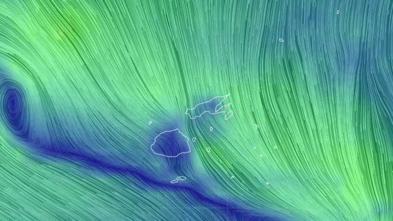
All maritime transport will be suspended from 6pm tonight.
NDMO Director, Vasiti Soko says this has been decided by the Maritime Safety Authority of Fiji.
Please secure your boats and do not go out to sea until the all clear is given.
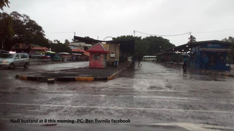
Nadi Bus Stand is starting to get flooded while the water-level at the Nadi River has reached the same level as the bridge.
All other crossings in the Nadi area are currently closed off to traffic and pedestrians due to flooding.
People are advised to move to higher ground if the area they are living in are prone to flooding.
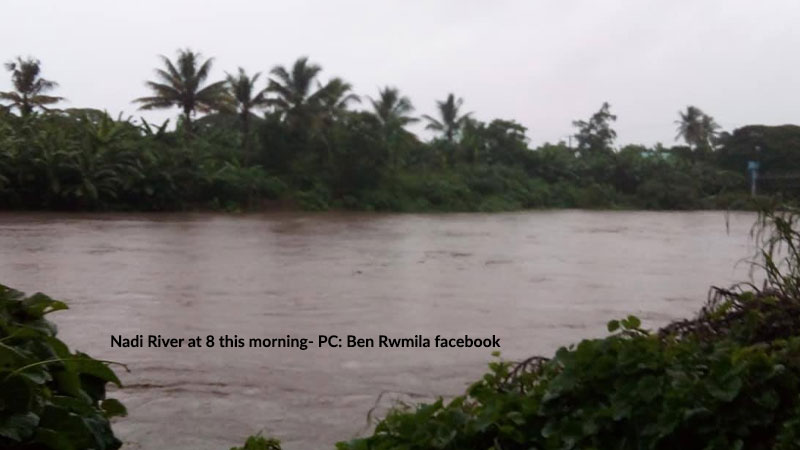
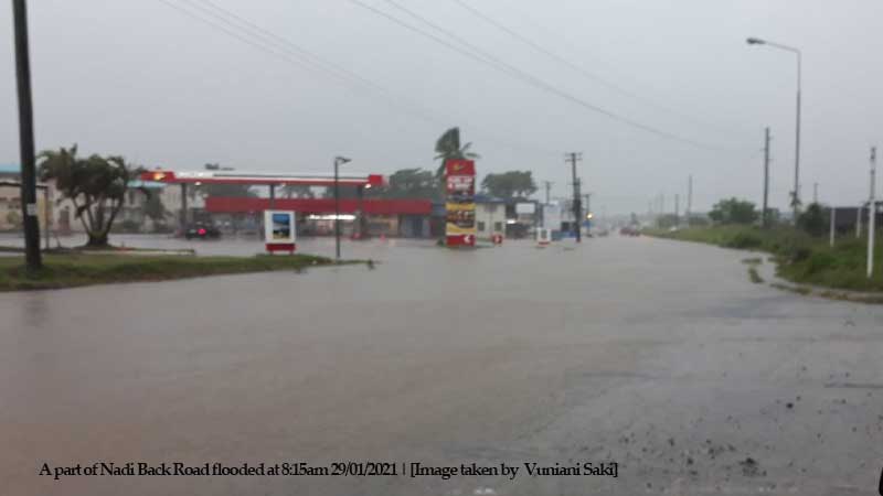
Several roads around the country are closed due to flash flooding.
Korovou Flats between Tavua Town and Nadarivatu Road junction is closed due to flooding.
The bridge at Nayavu in Wainibuka along Kings Highway is flooded.
A part of Nadi Back Road before the service station is also flooded.
Queens Highway at Navutu in Lautoka is also flooded.
Residential roads along Luvu in Lautoka are also flooded.
In the North, Nabouwalu Road from Labasa Town to Nabouwalu Jetty is clear and accessible.
This has been confirmed by the Fiji Roads Authority.
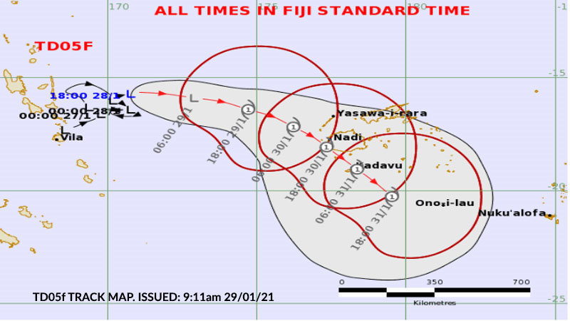
A Tropical Cyclone Warning is now in force for Fiji.
Acting Director of the Nadi Weather Office, Terry Atalifo says people should prepare for damaging winds, flash flooding and sea flooding.
Flooding is the immediate concern as a flash flood warning remains in force for all low lying areas and small streams near major rivers in Vanua Levu and Viti Levu.
If you are living near Labasa River, Qawa River - Vunivau stretch toward Vunika flat, Soasoa flat, Korotari flat in the North, and Nakauvadra River from Vatukacevaceva to Rakiraki Town, low lying areas along FSC Road, Tavua at Nasivi, low lying areas along with Ba FSC, low lying areas and areas adjacent to Navala River and Toge River, low lying areas and small streams for Keyasi River down to Sigatoka River and low lying areas and areas adjacent to Nadi Bridge – please take all the necessary precautions as your area can get flooded.
Expect damaging winds if you live in Vanua Levu, Taveuni and nearby smaller islands and Yasawa Group.
A strong wind warning remains in force for Viti Levu, Mamanuca Group, Kadavu and Lomaiviti Group.
A heavy rain warning remains in force for Northern Viti Levu which is from Lautoka to Rakiraki, Vanua Levu, Taveuni and nearby smaller islands, Yasawa, Lau Group and is now in force for the rest of Fiji.
Tropical Depression 05F is located East of Vanuatu or about 780 kilometres West North West of Nadi. It is currently slow-moving and is expected to track East then South East towards Fiji in the next 24 to 48 hours.
TD05F has a very high potential to intensify into a cyclone in the next 24 hours to 48 hours.
The associated active trough of low pressure with active rainbands and strong to damaging winds will affect us.
Expect the weather to worsen later today and there are forecasts that the Tropical Depression could become a cyclone as early as this afternoon.
Stay with us as we will keep you informed.

Several roads around the country are closed due to flash flooding.
Korovou Flats between Tavua Town and Nadarivatu Road junction is closed due to flooding.
The bridge at Nayavu in Wainibuka along Kings Highway is flooded.
A part of Nadi Back Road before the service station is also flooded.
Queens Highway at Navutu in Lautoka is also flooded.
Residential roads along Luvu in Lautoka are also flooded.
In the North, Nabouwalu Road from Labasa Town to Nabouwalu Jetty is clear and accessible.
This has been confirmed by the Fiji Roads Authority.

Nadi Bus Stand is starting to get flooded while the water-level at the Nadi River has reached the same level as the bridge.
All other crossings in the Nadi area are currently closed off to traffic and pedestrians due to flooding.
People are advised to move to higher ground if the area they are living in are prone to flooding.

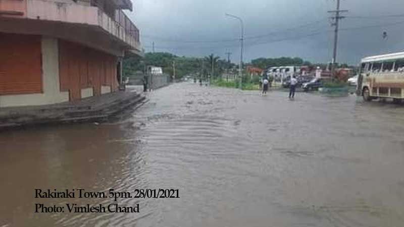
Parts of Rakiraki and Tavua Town are still flooded this morning.
Police are closing monitoring the situation in these two areas.
The Rakiraki Police Station says the town has been flooded since yesterday afternoon.
Naqoro Road is closed due to flooding.
The Tavua Police Station says they closed Yaqara Road as there is flooding up to Shop and Save Supermarket.
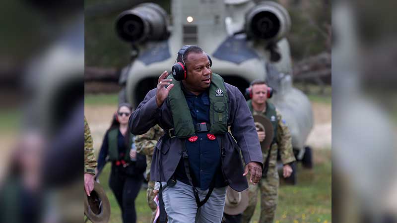
Schools in the Northern Division are closed based on the decision taken by the Commissioner Northern.
Minister for National Disaster Management, Inia Seruiratu says the NDMO has endorsed this based on the decision by the Commissioner Northern and the heavy rain warning, flash flood alert and strong wind warning in place.
Minister for Education, Rosy Akbar is yet to comment on plans for the weather situation.
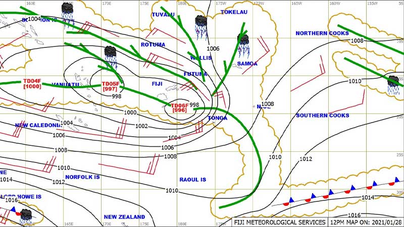
If you are living in Vanua Levu and nearby smaller islands, Yasawa and Mamanuca Group, a Tropical Cyclone Alert is now in force for your areas.
The Nadi Weather Office has also issued a Gale Warning for Vanua Levu and nearby smaller islands, Taveuni and Lau Group which means that you can get damaging winds.
There is a Strong Wind Warning for Northern Viti Levu which include areas from Lautoka, Ba to Rakiraki, and Yasawa, Mamanuca Group and Rotuma.
A Heavy Rain Warning is in place for Vanua Levu, Taveuni and nearby smaller islands, Lau Group, Yasawa Group and Northern Viti Levu while a Heavy Rain Alert is in place for the rest of Fiji.
A Flood Warning is in place for the low lying areas and small streams within Qawa River in Labasa – this includes Dreketilailai, Boubale and Urata Crossings, Vunivau stretch toward Vunika Flat, Nabouwalu to Kubulau, Dawara to Nabalebale Village along the Wailevu West Coast Road.
A Flash Flood Alert is also in place for the low lying areas in Vanua Levu and from Ba to Rakiraki in Viti Levu.
Expect heavy rain, strong winds, flooding and potential storm surges as Tropical Depression TD05F which is located East of Vanuatu is starting to become better organised and is expected to develop into a category 1 tropical cyclone within the next two days or earlier.
The Nadi Weather Office says TD05F is currently slow moving and expected to track towards Fiji in the next two days.
The tropical low that lies over Lau had upgraded to a Tropical Disturbance TD06F and further intensified to a depression.
Damaging winds associated with Tropical Depression TD06F is affecting the Lau Group. The system is currently slow moving and expected to move out of Lau waters in the next 24 hours. TD06F has a low potential to intensify into a tropical cyclone.
Meanwhile, Tropical Depression TD04F has weakened overnight and is located to the West of Vanuatu.
Damaging winds, heavy rain and thunderstorms are expected over Vanua Levu and nearby smaller islands, Taveuni and Lau Group. There is a possibility of flash flooding of low lying areas and sea flooding of coastal areas over these places.
For other areas, expect damaging winds from early Saturday morning.
Rain is expected to become frequent with thunderstorms from later today. Flash flooding of low lying areas and sea flooding of coastal areas is likely.
Expect damaging winds and high seas over waters of Northern Vanua Levu and Lau.
Extremely rough seas having a total wave height of 6 to 8 metres or more and heavy swells is anticipated. Possible storm surge with sea flooding of low lying coastal areas during high tides, with storm surge heights up to 2 to 3 metres are expected along the coast in the coming days when TD05F which is possibly a tropical cyclone by then as it tracks closer to the Fiji Group. Stay with for updates.
Stay tuned for the latest news on our radio stations

