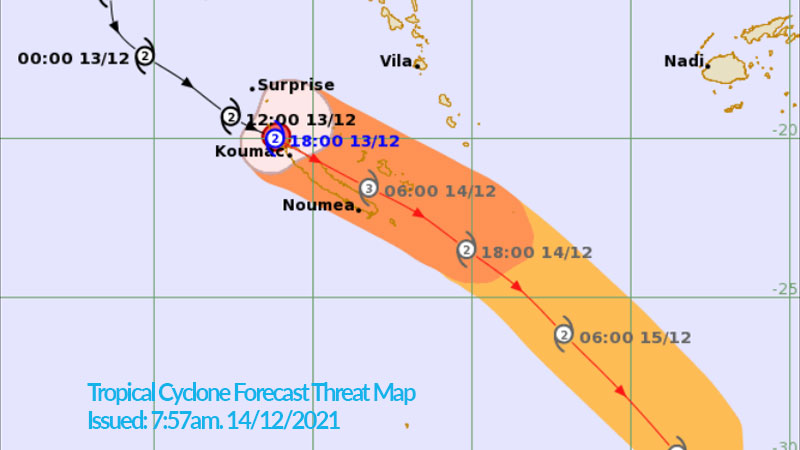
The Nadi Weather Office says Tropical Cyclone Ruby is not expected to have any direct threat over the Fiji Group however the wider Suva area should expect some heavy downpour from Thursday.
It says rain has been falling for the last couple of days and with already saturated soil, there is a possibility of flash floods and landslides in areas of heavy rain and flood-prone areas.
The Weather Office says as the system passes to the far south of Fiji, expect the northerly wind flow to be dominating over the group from Thursday.
It says typically, when northerly wind flows are over Fiji, it brings humid conditions, heavy rain, thunderstorm activity and gusty winds over the group.
These associated weather conditions are expected over Fiji from Thursday and ease off on Sunday.
The northern and western parts of Viti Levu, Vanua Levu, Taveuni, Kadavu, Yasawa and Mamanuca Group will mainly be impacted as these are areas exposed to the northerly winds.

TC Ruby threat map issuesd by M.E.T office at 7:57am today.
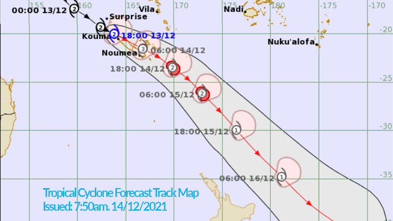
The Weather Office says TC Ruby has not intensified further as anticipated last night and is still a category 2 system. However, this morning clouds and thunderstorms have started rotating over the weather system with the centre currently located just over the northern tip of New Caledonia.
TC Ruby is bringing a lot of rain with damaging gale to destructive storm force winds over New Caledonia.
The cyclone is expected to further intensify into a category 3 system by this afternoon to tonight.
The weather system is expected to continue to move east southeast across New Caledonia, to the far south of Fiji and North of New Zealand.
The Weather Office will continue to monitor this weather event and update warnings and forecasts accordingly.
Stay tuned for the latest news on our radio stations


