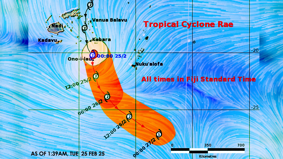
Expect strong winds, heavy rain and flooding as Category 2 Tropical Cyclone Rae continues to track slowly towards the Southern Lau group.
The Nadi Weather Office says the centre of Cyclone Rae is located about 55km North of Ono-i-Lau or about 140km South of Kabara.
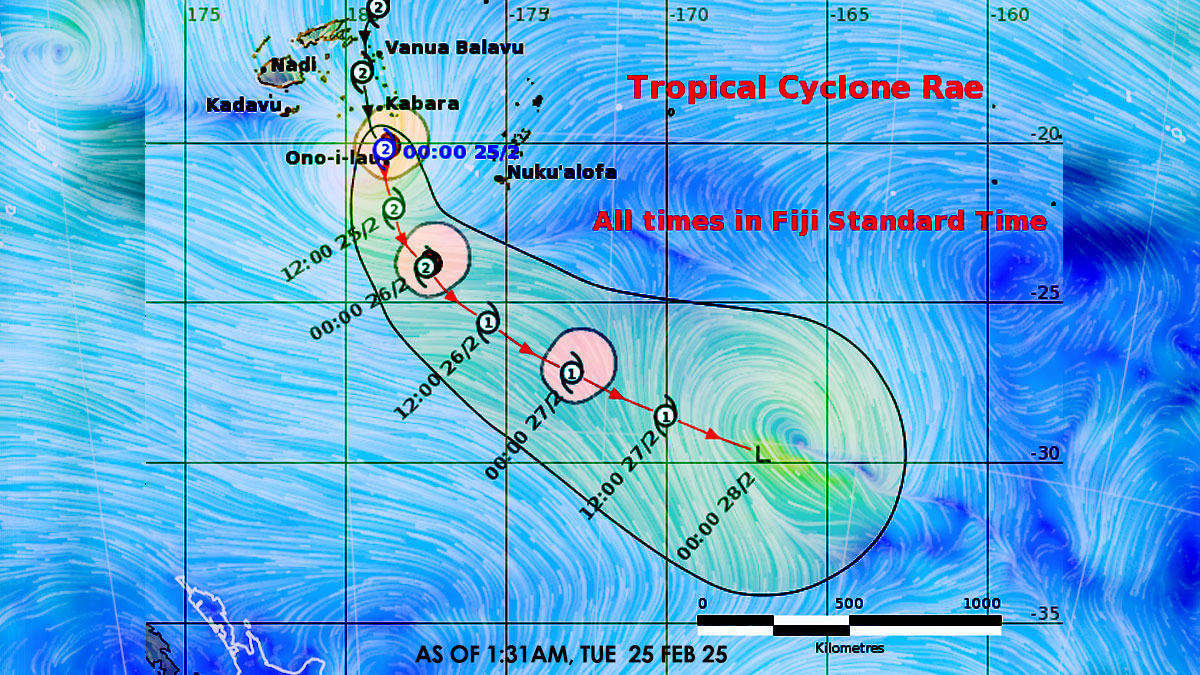
It is moving South-southeast at about 19 kilometres per hour over Southern Lau Group.
A storm warning remains in force for Vatoa and Ono-i-Lau.
A gale warning remains in force for Lakeba, Oneata, Moce, Komo, Namuka-i-Lau, Kabara, Fulaga, Ogea and Totoya.
TC Rae is expected to slowly intensify while tracking South-southwest over the Southern Lau Group.
Meanwhile, an active convergence zone with associated strong to gale force winds will affect the Northern and Eastern parts of the group.
For Vatoa and Ono-i-Lau: Expect gale to storm force winds with wind speeds from 65km/hr to 110km/hr and gusts from 90km/hr to 155km/hr.
Winds gradually easing to strong to gale with wind speeds up to 75km/hr and gusts up to 100km/hr by morning.
For Lakeba, Oneata, Moce, Komo, Namuka-i-Lau, Kabara, Fulaga, Ogea and Totoya: Expect strong to gale force winds with wind speeds from 45km/hr to 85km/hr and gusts from 80km/hr to 120km/hr.
A gale warning remains in force for the Eastern parts of Vanua Levu [Cakaudrove province, Eastern Macuata and Southern Bua], Cikobia, Naqelelevu, Taveuni, Koro, Ovalau and Ono-i-Lau.
Expect strong to gale force winds with wind speeds from 45km/hr to 85km/hr and gusts from 80km/hr to 120km/hr.
A strong wind warning remains in force for the rest of Vanua Levu, Northeastern parts of Viti Levu [from Tailevu North through Ra-Rakiraki up to Tavua], Yasawa, Mamanuca, Kadavu and nearby smaller islands.
For the Eastern and Northern parts of Viti Levu [from Sigatoka through Suva to Tailevu North up to Rakiraki/Tavua], Yasawa, Mamanuca, Kadavu and nearby smaller islands: expect fresh to strong southeasterly wind speeds up to 55km/hr and gusts up to 80km/hr.
A heavy rain warning remains in force for the whole of Fiji group.
A flash flood warning is in force for all small streams and low lying flash flood prone areas of Viti Levu and Vanua Levu.
Possible impacts expected from the tropical cyclone: - significant structural damage to houses of unshielded and very light structures in exposed communities. - possible disruption in communication network and power supply due to damaged power lines. - trees/plants and crops damaged and downed. - high risk of sea travel for all types of sea crafts.
Possible impacts due to heavy rain: - localised flooding of susceptible communities, business and low lying areas. - localised flooding of minor roads, Irish crossings and bridges with some disruption to traffic flow. - severe flooding of major rivers which could flood towns and properties. - poor visibility for drivers and mariners.

Stay tuned for the latest news on our radio stations