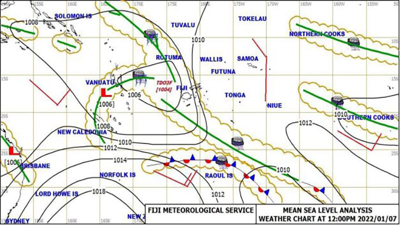
Expect more rain, strong winds and the possibility of flooding from Sunday as Acting Director of Meteorology Terry Atalifo says the concern now is that Tropical Disturbance O3F has a moderate to high chance of becoming a cyclone by Monday.
Atalifo says as of 12pm today, TD03F was located about 440 kilometres west-northwest of Nadi.
TD03F is moving southwest at 45 kilometres per hour.
TD03F is expected to be slow moving to the southwest of Fiji till early next week due to a high pressure system situated to the far south of Fiji.
Atalifo says if TDO3F becomes a cyclone, it will remain to the west of Fiji.
He adds they anticipate heavy rain and strong winds to affect Fiji from Sunday to Wednesday.
Atalifo also says flooding is a major concern.
The system is also expected to bring strong to damaging gale force winds of up to 85 kilometres per hour with wind gusts of up to 120 kilometres per hour over the western and southern parts of Vanua Levu, Yasawa and Mamanuca Group, northern and western parts of Viti Levu, Beqa, Vatulele and Kadavu.
Winds of this strength can cause significant damage to houses of very light materials or unshielded structures with blown roof in exposed communities, damage power lines and disrupt communication networks, damage plants and crops, break twigs of small trees and cause disruption to travel/transport.
A heavy rain warning remains in force for the Northern Division, Viti Levu, Yasawa and Mamanuca Group, Kadavu and nearby smaller islands.
A flash flood warning remains in force for all low lying and flood prone areas of Vanua Levu and a flash flood alert remains in force for all low lying and flood prone areas in Nadi through to Lautoka, Ba, Tavua, Rakiraki and Korovou.
An active trough of low pressure with associated cloud and rain affects the Fiji group.
Stay tuned for the latest news on our radio stations

