A flood warning is now in force for areas near major rivers in Vanua Levu as a trough of low pressure affects the Northern parts of Fiji while the Tropical Depression and the Tropical Disturbance located to the north-northwest of Fiji continues to track towards the group.
The trough of low pressure is expected to bring heavy rainfall as it moves closer towards the Group.

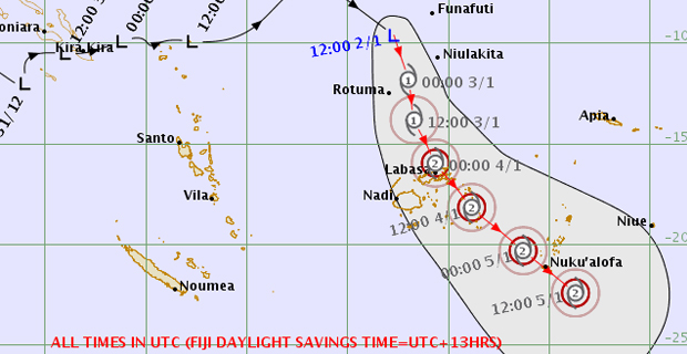
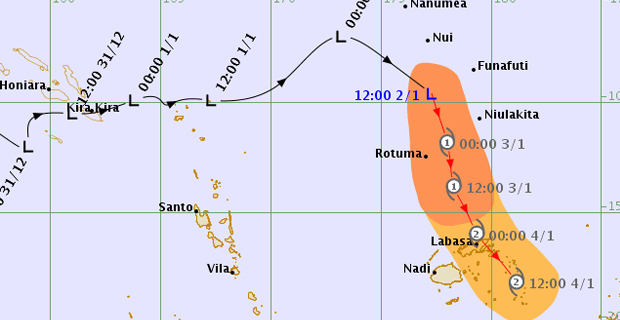
TDO4F Threat Track Map 0256am 3rd Jan 2019 [Photo: met.gov.fj]
A heavy rain warning is also in force for Vanua Levu, Taveuni, Eastern half of Viti Levu which includes Navua, Rewa to Wainibuka and the Lau and Lomaiviti groups.
The Tropical Depression and Tropical Disturbance are expected to merge and the effects of the system is expected to be felt from late tomorrow into Saturday as it tracks towards the Fiji Group.

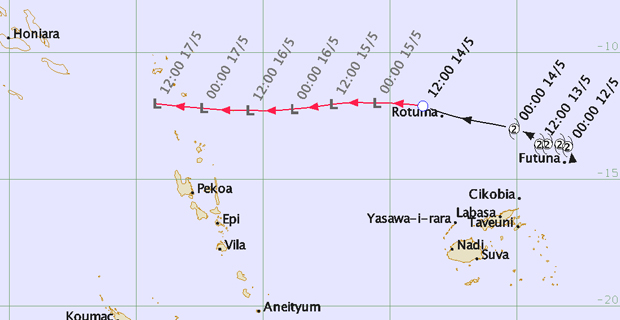
Second Threat Track Map of TDO5F at 0256am 3rd Jan 2019 [Photo: met.gov.fj]
The Weather Office says there is a possibility that the weather system may intensify into a category 2 Tropical Cyclone as it enters the Fiji waters.
Gale force winds are expected to start affecting Rotuma from tonight into tomorrow morning.
They expect the center to pass over Vanua Levu and gale force winds will be expected over Vanua Levu, Yasawa, Lau and Lomaiviti Group and northern parts of Viti Levu from Rakiraki to Tailevu North.
The Tropical Depression is moving southeast at about 30 kilometres per hour and may further intensify into a Tropical Cyclone in the next 12 to 18 hours.
The Weather Office says there is a risk of flash flooding in low‑lying and flood‑prone areas therefore, all communities living in the flood prone and landslide areas should remain alert and take precautions when necessary.
Stay tuned for the latest news on our radio stations

