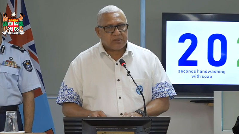
Prime Minister Voreqe Bainimarama says Tropical Cyclone Harold will enter the Fijian waters tomorrow, and we can expect strong winds and heavy rain in the Yasawa and Mamanuca groups, Viti Levu, Kadavu, the Lomaiviti Group and the Southern Lau Group. Bainimarama says if any areas under lockdown see serious flooding and need to be evacuated, the government has contingency plans in place to prevent any mixing between evacuees and Fijians who are close contacts of existing COVID-positive patients.

The Prime Minister says all evacuation centres will also be sanitised, and regularly monitored to ensure that they are not filled beyond capacity. Bainimarama says through this storm, he wants to again stress that the directives given by the authorities are not voluntary. He says they are not suggestions.
The Prime Minister says they are orders that must be followed, for your safety and the safety of those around you. Bainimarama advises people to stay away from floodwaters. If you’ve been directed to evacuate, please do so while the sun is out. If you have not been told to move, do the right thing and stay put at home.

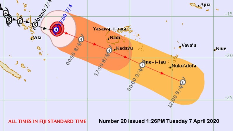
People are advised to take all precautionary measures now as continuous heavy rain and damaging winds are expected in Fiji from later today into tomorrow as Category 4 Tropical Cyclone Harold comes closer to the group.
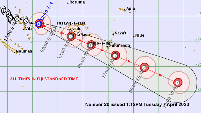
The centre of TC Harold is currently located 600 kilometres west of Nadi. Harold is forecast to be a strong category 4 cyclone as it reaches closest to Fiji tomorrow.
It is travelling in an east-southeast direction at about 15 kilometres per hour. The Nadi Weather Office and Na Draki are both saying while it is predicted that Cyclone Harold will not make landfall over any of the islands of Fiji, the centre will pass close enough to the Mamanucas, southern Yasawas, Viti Levu, Vatulele, Beqa, Kadavu and southern Lau that they will very likely experience damaging winds with gusts to 90 kilometres per hour starting from later tonight into tomorrow and continuing for much of the day.

Kadavu and southern Lau will likely experience more destructive storm force winds gusting to 125 kilometres per hour during the middle of the day and through to the evening tomorrow.
Widespread heavy rain is expected across Fiji from today ahead of the cyclone.
Rain will continue tonight and through the day tomorrow with flash flooding initially followed by river flooding tomorrow, especially for the Nadi and Sigatoka rivers, but also the Navua and Ba rivers, and also later the Rakiraki river and the Rewa from the interior to Nausori.
The onset of gales around western and southern Viti Levu will coincide with high tide and a full moon around sunrise tomorrow with a high risk of sea flooding along the Coral Coast and western Viti Levu, and also coastal villages and tourist resorts in the Mamanucas and Yasawas. While the forecast guidance remains consistent in predicting that the centre of TC Harold will pass about 300 kilometresor more south of Viti Levu later tomorrow, the track could potentially change over the next 24 hours so you should prepare for the possibility of stronger winds than predicted should the cyclone move closer to Fiji.
Expected continuous heavy rain increasing further tonight with widespread local flash flooding about the western, central and northern divisions.
Heavy rain will then spread to the eastern division by tomorrow morning.
The one element of positivity is that the cyclone will be travelling at around 20 kilometres by this time and its presence in Fiji waters will be relatively brief in comparison to Vanuatu.
By tomorrow night the centre of the cyclone will be moving out of southern Lau waters.
Stay tuned for the latest news on our radio stations


