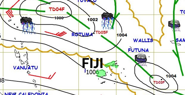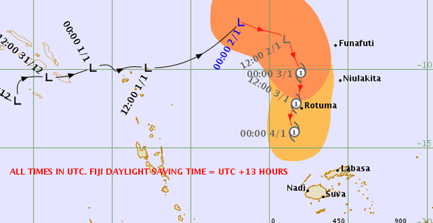
The Tropical Depression and the Tropical Disturbance located to the north-northwest of Fiji are expected to merge, further intensify into a Tropical Cyclone and head towards Fiji.
This is according to Nadi Weather Office Senior Forecaster, Amit Singh who says there is a moderate to high chance for a Tropical Cyclone to develop within the next 30 to 42 hours and head towards Fiji.
He says there is a possibility that the weather system may intensify into a category 2 Tropical Cyclone as it enters the Fiji waters.
He says the effects of this system is expected to be felt from late Friday into Saturday as it tracks towards the Fiji Group.

Weather Map showing the Tropical Depression and the Tropical Disturbance located to the north-northwest of Fiji [Photo: met.gov.fj]
Gale force winds are expected to start affecting Rotuma from Thursday night into Friday morning.
Singh says with the current forecast, most parts of the country are expected to receive a lot of rain from Friday.
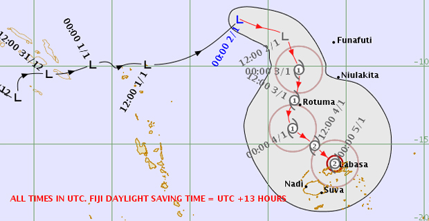
He says with the two weather systems expected to merge and head towards Fiji, they expect the center to pass over Vanua Levu and gale force winds will be expected over Vanua Levu, Yasawa, Lau and Lomaiviti Group and northern parts of Viti Levu from Rakiraki to Tailevu North.

TDO4F Threat Track Map 03:03pm 2nd-Jan-2019 [Photo: met.gov.fj]
Singh says this is based on the current forecast and if there is a shift in their forecast track, then the areas can change.
Meanwhile, a strong wind warning remains in force for all land areas of Lau and Lomaiviti Group, Kadavu and nearby smaller islands, Yasawa, Vanua Levu and Northern Viti Levu from Rakiraki to Tailevu North.
A heavy rain warning is also in force for Vanua Levu, Taveuni and nearby smaller islands, Lau and Lomaiviti Group and eastern half of Viti Levu which includes the Central Division.
This is because of an active trough of low pressure which is moving towards Fiji from the north.
Stay tuned for the latest news on our radio stations

