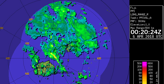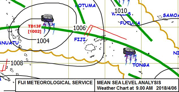
The trough of low pressure currently affecting the Fiji Group is expected to bring heavy rain in many parts of the country from today into this weekend.
This is highly likely to result in flooding and even river flooding in the Western and Northern divisions from today going into the weekend.
The Nadi Weather Office says this is an active trough of low pressure which is slow moving over Fiji.
Heavy rain warnings, heavy rain alerts and flood warnings have been issued because of the trough of low pressure.
A heavy rain warning remains in force for the Western Division which is from Sigatoka to Rakiraki, Yasawa and Mamanuca, Vanua Levu, Taveuni and nearby smaller islands, Lomaiviti and Northern Lau Group.
A heavy rain alert remains for the rest of Fiji.
A flood warning is in force for the low lying areas, small streams and areas adjacent downstream of Vatukacevaceva to Rakiraki Town, the low lying areas, small streams and areas adjacent downstream of Dreketilailai to Qawa River and is now in force for the low lying areas, small streams and areas adjacent to downstream of Nasivi to Tavua.
A flood alert remains in force for the low lying areas, small streams and streams adjacent to the rest of the major rivers of the Western Division which is from Sigatoka to Rakiraki, Vanua Levu and Taveuni.

Weather map as at 9am Friday 6th April 2018 [met.gov.fj]
On to the second system that is approaching Fiji,
The Tropical Depression was analyzed to the far North West of Fiji near Vanuatu this morning and it will possibly intensify further into a Tropical Cyclone as it moves towards Fiji and brings about strong to damaging winds with heavy rain over the Fiji Group.
The Weather Office says at this stage, the system is expected to take a similar track as Tropical Cyclone Josie, passing South West of the Group early next week. It is likely that the system will be stronger than Josie and depending on how far from the Group it tracks, the likely impacts may be similar or even worse if it tracks closer to land areas.
Please note that with more rain forecast and soil being saturated, there is high risk of severe river flooding especially in the Western Division. The approaching system has the potential to produce more than 120mm of rainfall in 24 hours this weekend.
As the system moves closer to the Group, expect periods of heavy rain and thunderstorms with rough to very rough seas in the weekend and could even increase to high seas.

Damaging heavy swells is also expected with high risk of severe river flooding.
People living in flood prone and low lying areas are reminded to take all necessary precautions and remain alert and to keep listening to us for latest weather updates.
The Weather Office will continue monitoring the situation closely and any alert and warning will be issued as and when necessary.

Stay with us for continuous updates.
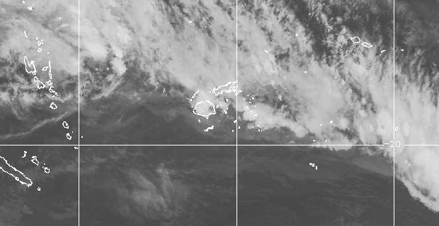
Photo type No photo Keep existing photo Standard Wide Current picture Click here to view Picture Picture description Satellite Loop as at 12.20am Friday 6th April 2018 [Image: met.gov.fj] Has Audio? Has Video? News type News by Vijay Narayan Status © Communications Fiji Limited | Powered by Infotech Consultants. For control panel support, email support@infotech.com.fj
Stay tuned for the latest news on our radio stations


