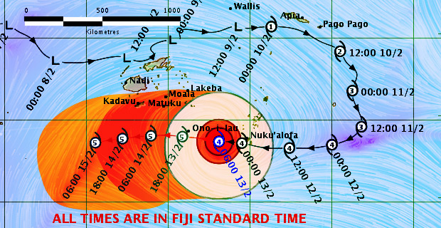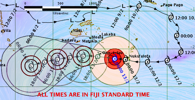
People are advised to be prepared for strong winds and heavy rain from today as the centre of Severe Tropical Cyclone Gita is expected to enter the Fiji waters over the Southern Lau Group from tonight into early tomorrow morning.
In the latest update this morning, the Weather Office says on its projected path Tropical Cyclone Gita is expected to enter the Fiji Waters as a Category 5 system with destructive winds.
A hurricane warning remains in force for Ono-i-Lau and Vatoa.
People living in Matuku, Totoya, Moala, Kadavu and nearby smaller islands, Lakeba and Nayau should also expect strong and damaging winds.
Sea flooding of coastal areas is also expected in these areas.
A strong wind warning is also in force for the rest of Fiji.
This includes Viti Levu and Vanua Levu.

Cylcone Gita Forecast Track map as at 7.22am Tue 13 Feb 2018
Please note that destructive winds are likely to begin several hours before the cyclone passes overhead or nearby.
The Weather Office says the country can start expecting strong winds, heavy rain and high seas from later today.
The centre of Cyclone Gita is about 200 kilometres East South East of Ono‑i‑Lau.
Close to the Cyclone’s centre, the average winds are up to 195 kilometres per hour with momentary gusts to 275 kilometres per hour.
Expect very strong and destructive winds.
The Weather Office says on this track the Category 4 Cyclone Centre is expected to be located about 85 kilometres South of Ono-i-Lau late this afternoon into tonight.
The Weather Office will continue to monitor the system as it comes closer and as new information comes to hand, the projected tracks will be adjusted.
Stay tuned for the latest news on our radio stations


