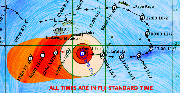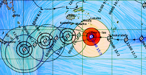
Strong winds have started picking up in Ono-i-Lau and surrounding areas from the last hour as Tropical Cyclone Gita continues to move towards the southern part of the Fiji waters.
A hurricane warning remains in force for Ono-i-Lau and Vatoa while storm and gale warnings are in force for the rest of Southern Lau Group, Matuku, Totoya, Moala, Kadavu and nearby smaller islands, Lakeba and Nayau.
A strong wind warning is in force for the rest of Fiji including Viti Levu and Vanua Levu.
The Nadi Weather Office says Category 4 Severe Tropical Cyclone Gita was located about 130 kilometres East South East of Ono-i-Lau.

Cyclone Gita Forecast track update as of 1.43PM today [met.gov.fj]
Close to the centre, the cyclone is expected to have average winds of up to 195 kilometres per hour with momentary gusts to 275 kilometres per hour.
The Weather Office also confirms that average wind speeds will increase to 215 kilometres per hour with momentary gusts to 295 kilometres per hour from midday today.
On this track, the centre of Cyclone Gita is expected to be located about 140 kilometres West South West of Ono-i-Lau at 9 tonight. Gita will be a Category 5 cyclone when it passes the Lau Group.
Please note that destructive winds are likely to begin several hours before the cyclone passes overhead or nearby.
As Gita comes into our waters later today into tonight, expect destructive hurricane force winds, heavy rain and sea flooding in Ono-i-Lau and Vatoa.
Destructive winds, heavy rain and sea flooding is also expected for people living in Southern Lau, Kadavu and nearby smaller islands.
For the rest of Fiji, expect heavy rain and strong winds.
The Weather Office will continue to monitor the system as it comes closer and as new information comes to hand, the projected tracks will be adjusted.
Stay tuned for the latest news on our radio stations

